
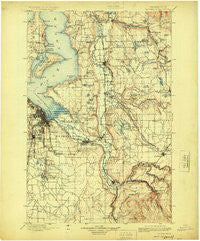
~ Tacoma WA topo map, 1:125000 scale, 30 X 30 Minute, Historical, 1900, updated 1924
Tacoma, Washington, USGS topographic map dated 1900.
Includes geographic coordinates (latitude and longitude). This topographic map is suitable for hiking, camping, and exploring, or framing it as a wall map.
Printed on-demand using high resolution imagery, on heavy weight and acid free paper, or alternatively on a variety of synthetic materials.
Topos available on paper, Waterproof, Poly, or Tyvek. Usually shipping rolled, unless combined with other folded maps in one order.
- Product Number: USGS-5411446
- Free digital map download (high-resolution, GeoPDF): Tacoma, Washington (file size: 9 MB)
- Map Size: please refer to the dimensions of the GeoPDF map above
- Weight (paper map): ca. 55 grams
- Map Type: POD USGS Topographic Map
- Map Series: HTMC
- Map Verison: Historical
- Cell ID: 66747
- Scan ID: 244183
- Imprint Year: 1924
- Survey Year: 1895
- Datum: Unstated
- Map Projection: Polyconic
- Map published by United States Geological Survey
- Map Language: English
- Scanner Resolution: 600 dpi
- Map Cell Name: Tacoma
- Grid size: 30 X 30 Minute
- Date on map: 1900
- Map Scale: 1:125000
- Geographical region: Washington, United States
Neighboring Maps:
All neighboring USGS topo maps are available for sale online at a variety of scales.
Spatial coverage:
Topo map Tacoma, Washington, covers the geographical area associated the following places:
- Tacoma Country Estates Mobile Home Park - Fairwood - Lakeview - Country Road Estates Mobile Home Park - Redondo - Mirrormount Estates - Harvard View Mobile Home Park - Bow Lake Residential Mobile Home Community - Cedar Grove - Palisades Mobile Home Estates - Bonney Lake - Star Lake - Beverly Park - Thrift - Southgate Mobile Home Park - Bethel Park - Bowman Hilton Mobile Home Park - Parkland - Old Tacoma - Upper Fairfax - Kummer - McMillin - Orillia - Browns Point - Larchmont - Alpine Mobile Home Park - Rhododendron Park - Kitts Corner - Maple Hills - North Puyallup - Lone Cedar Mobile Home Park - Pine Terrace Mobile Home Park - Pacific - Buenna - Carbonado - Des Moines Estates Mobile Home Park - Hillsdale - McVan - Lake Meridian Estates Mobile Home Park - Valleybrook Mobile Home Park - View Crest Mobile Manor - Frederickson - Deer Run Mobile Home Park - Summer Villa Estates Mobile Home Park - Fruitland Gardens Mobile Home Park - South Hill - High Valley - Midway - Cascade Green Mobile Home Park - Meadowbrook Mobile Home Park - Lakeside Terrace Mobile Home Park - Camelot Square Mobile Home Park - Shady Hill Mobile Home Park - Don Juan Mobile Home Park - Winchester Village Mobile Home Park - Federal Way - Willo Vista Mobile Estates - The Firs Mobile Home Park - Evergreen Manor Mobile Home Park - Ponderosa Estates - Hylebos Creek Mobile Home Park - Excelsior - Kloshe Illahee Mobile Home Park - Harbor Heights - Fairfield Mobile Home Park - Cascade - Highlands Park - Summerville Estates Mobile Home Park - Spring Valley Mobile Home Park - Wilkeson - Seola Beach - Ardenia Gale Mobile Home Park - Des Moines - Valley View Mobile Home Park - Franklin Pierce Mobile Estates - Cascade Junction - Dockton - Hidden Glen Mobile Home Park - White River Estate Mobile Home Park - Skylark Village II Mobile Home Park - Sound Vista Mobile Home Park - Fir Lane Valley Mobile Home Park - Shadow Pines Mobile Estates - Buckley - Auburn Green Mobile Home Park - Golden Valley Mobile Home Park - Morganville - Hongking (historical) - Brookdale - Northeast Tacoma - Dilworth - Vashon - Woodland Estates Mobile Home Park - Wabash - Twin Oaks Mobile Home Park - Midland - South Hill Palisade Mobile Home Park - Mountain View Estates Mobile Home Park - Berrydale - Mountain Valley Mobile Home Park
- Map Area ID: AREA47.547-122.5-122
- Northwest corner Lat/Long code: USGSNW47.5-122.5
- Northeast corner Lat/Long code: USGSNE47.5-122
- Southwest corner Lat/Long code: USGSSW47-122.5
- Southeast corner Lat/Long code: USGSSE47-122
- Northern map edge Latitude: 47.5
- Southern map edge Latitude: 47
- Western map edge Longitude: -122.5
- Eastern map edge Longitude: -122


