
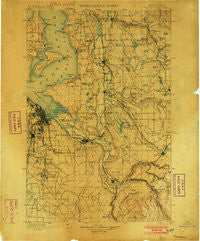
~ Tacoma WA topo map, 1:125000 scale, 30 X 30 Minute, Historical, 1900, updated 1902
Tacoma, Washington, USGS topographic map dated 1900.
Includes geographic coordinates (latitude and longitude). This topographic map is suitable for hiking, camping, and exploring, or framing it as a wall map.
Printed on-demand using high resolution imagery, on heavy weight and acid free paper, or alternatively on a variety of synthetic materials.
Topos available on paper, Waterproof, Poly, or Tyvek. Usually shipping rolled, unless combined with other folded maps in one order.
- Product Number: USGS-5411438
- Free digital map download (high-resolution, GeoPDF): Tacoma, Washington (file size: 10 MB)
- Map Size: please refer to the dimensions of the GeoPDF map above
- Weight (paper map): ca. 55 grams
- Map Type: POD USGS Topographic Map
- Map Series: HTMC
- Map Verison: Historical
- Cell ID: 66747
- Scan ID: 244179
- Imprint Year: 1902
- Survey Year: 1895
- Datum: Unstated
- Map Projection: Unstated
- Map published by United States Geological Survey
- Map Language: English
- Scanner Resolution: 600 dpi
- Map Cell Name: Tacoma
- Grid size: 30 X 30 Minute
- Date on map: 1900
- Map Scale: 1:125000
- Geographical region: Washington, United States
Neighboring Maps:
All neighboring USGS topo maps are available for sale online at a variety of scales.
Spatial coverage:
Topo map Tacoma, Washington, covers the geographical area associated the following places:
- Rhododendron Mobile Home Park - Klahanie - Manitou - Dilworth - Lea Hill - SeaTac - Wilderness - Brookdale - Three Ponds Mobile Home Park - Cebalop (historical) - Wilkeson Gardens Mobile Home Park - Croker - Miller's Villa Mobile Home Park - North Hill - Mountain Valley Mobile Home Park - Pine Terrace Mobile Home Park - Leisure Estates Mobile Home Park - Highlands Park - Glen Acres - Bonney Lake - May Valley Manor Mobile Home Park - Woodland Estates Mobile Home Park - Meridian Mobile Estates - Americana Mobile Home Park - South Prairie - Lake Bowman Mobile Home Park - Carriage Mobile Home Court - Cherokee Bay Park - The Firs Mobile Home Park - Skyway Mobile Home Park - Tall Firs Estates Mobile Home Park - Laurelwood Valley Mobile Home Park - Soos Creek Mobile Home Estates - Alpine Mobile Home Park - Atkinson - Dockton - Upper Fairfax - Charleton Lake Estates Mobile Home Park - Town and Country Villa Mobile Home Park - Elliott - Tukwila - Arcadia - Oakridge Manor Mobile Home Park - Leisure Manor Mobile Community - Prairie Ridge - Loveland - Maple Valley - Beverly Park - Whispering Firs Mobile Home Park - Vermontville (historical) - Hidden Glen Mobile Home Park - Adelaide - Midland Meadows Mobile Home Park - Meridian Terrace Mobile Manor - Redondo - Country West Mobile Home Park - Northeast Tacoma - Riverbend Mobile Home Park - Don Juan Mobile Home Park - Seola Beach - Valley Mobile Manor - Dorre Don - Cherrywood Mobile Home Manor Sewage Treatment Plant - Auburn Manor Community Mobile Home Park - Spring Valley Mobile Home Park - Sunnydale - Midland - Berkeley - Mar A Villa Mobile Home Park - Thrift - Twin Flags Mobile Home Community - Diru Mobile Home Park - White River Estate Mobile Home Park - One Hundred Thirty - Eighth Park Mobile Estates - Delray Mobile Home Park - Bonel Mobile Manor - Horseshoe Acres Mobile Home Park - Fairfield Mobile Home Park - Maple Valley Heights - Golden Valley Mobile Home Park - Wynaco - Summerhurst - Mirrormount Estates - North Puyallup - Heather Hills Mobile Home Park - Fruitland Gardens Mobile Home Park - Southgate Mobile Home Park - Woodmont Beach - Canyon Glen Mobile Home Park - Tahoma - Coach Country Corral Mobile Home Park - Ellisport - Tyee Valley Mobile Manor - Cowley - Clover Creek Trailer Court - Wabash - Lakeside Terrace Mobile Home Park - View Crest Mobile Home Park - Spanaway Mobile Village - Greenwood Mobile Home Park
- Map Area ID: AREA47.547-122.5-122
- Northwest corner Lat/Long code: USGSNW47.5-122.5
- Northeast corner Lat/Long code: USGSNE47.5-122
- Southwest corner Lat/Long code: USGSSW47-122.5
- Southeast corner Lat/Long code: USGSSE47-122
- Northern map edge Latitude: 47.5
- Southern map edge Latitude: 47
- Western map edge Longitude: -122.5
- Eastern map edge Longitude: -122


