
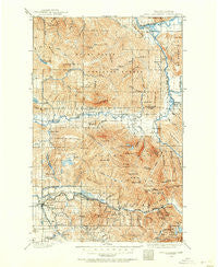
~ Stillaguamish WA topo map, 1:125000 scale, 30 X 30 Minute, Historical, 1899, updated 1955
Stillaguamish, Washington, USGS topographic map dated 1899.
Includes geographic coordinates (latitude and longitude). This topographic map is suitable for hiking, camping, and exploring, or framing it as a wall map.
Printed on-demand using high resolution imagery, on heavy weight and acid free paper, or alternatively on a variety of synthetic materials.
Topos available on paper, Waterproof, Poly, or Tyvek. Usually shipping rolled, unless combined with other folded maps in one order.
- Product Number: USGS-5411408
- Free digital map download (high-resolution, GeoPDF): Stillaguamish, Washington (file size: 13 MB)
- Map Size: please refer to the dimensions of the GeoPDF map above
- Weight (paper map): ca. 55 grams
- Map Type: POD USGS Topographic Map
- Map Series: HTMC
- Map Verison: Historical
- Cell ID: 66700
- Scan ID: 244056
- Imprint Year: 1955
- Survey Year: 1899
- Datum: Unstated
- Map Projection: Polyconic
- Map published by United States Geological Survey
- Map Language: English
- Scanner Resolution: 600 dpi
- Map Cell Name: Stillaguamism
- Grid size: 30 X 30 Minute
- Date on map: 1899
- Map Scale: 1:125000
- Geographical region: Washington, United States
Neighboring Maps:
All neighboring USGS topo maps are available for sale online at a variety of scales.
Spatial coverage:
Topo map Stillaguamish, Washington, covers the geographical area associated the following places:
- Silverton - Fortson - Granite Falls - Halterman - Pilchuck Mobile Park - Hazel - Tulker - Swede Heaven - Rockport - Robe - Lake Bosworth - Verlot - Andron - White Horse - Pilchuck - Cascade Kamloops Trout Farm Mobile Home Park - Rowan - Darrington - Darrington Mobile Home Park 1 - Oso - Barco - Darrington Mobile Home Park 2 - Mansford - Sauk
- Map Area ID: AREA48.548-122-121.5
- Northwest corner Lat/Long code: USGSNW48.5-122
- Northeast corner Lat/Long code: USGSNE48.5-121.5
- Southwest corner Lat/Long code: USGSSW48-122
- Southeast corner Lat/Long code: USGSSE48-121.5
- Northern map edge Latitude: 48.5
- Southern map edge Latitude: 48
- Western map edge Longitude: -122
- Eastern map edge Longitude: -121.5


