
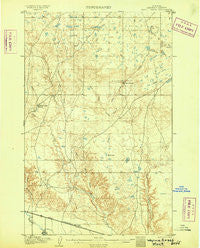
~ Wayne Creek MT topo map, 1:62500 scale, 15 X 15 Minute, Historical, 1905
Wayne Creek, Montana, USGS topographic map dated 1905.
Includes geographic coordinates (latitude and longitude). This topographic map is suitable for hiking, camping, and exploring, or framing it as a wall map.
Printed on-demand using high resolution imagery, on heavy weight and acid free paper, or alternatively on a variety of synthetic materials.
Topos available on paper, Waterproof, Poly, or Tyvek. Usually shipping rolled, unless combined with other folded maps in one order.
- Product Number: USGS-5401456
- Free digital map download (high-resolution, GeoPDF): Wayne Creek, Montana (file size: 8 MB)
- Map Size: please refer to the dimensions of the GeoPDF map above
- Weight (paper map): ca. 55 grams
- Map Type: POD USGS Topographic Map
- Map Series: HTMC
- Map Verison: Historical
- Cell ID: 64329
- Scan ID: 268357
- Survey Year: 1903
- Datum: Unstated
- Map Projection: Unstated
- Map published by United States Geological Survey
- Map Language: English
- Scanner Resolution: 600 dpi
- Map Cell Name: Wayne Creek
- Grid size: 15 X 15 Minute
- Date on map: 1905
- Map Scale: 1:62500
- Geographical region: Montana, United States
Neighboring Maps:
All neighboring USGS topo maps are available for sale online at a variety of scales.
Spatial coverage:
Topo map Wayne Creek, Montana, covers the geographical area associated the following places:
- Grable Coulee Spring - Thirtymile Reservoir - Matador (historical) - Terry Dam - Aveil Ravine - Mohair Number 1 Dam - Violett School (historical) - Grable Coulee - Mohair Number 2 Dam - West Fork Wayne Creek - East Savoy Creek - Cherry Patch School (historical) - Sunny Dam - Old Woman Reservoir Dam - Hungover Dam - East Fork Wayne Creek - Grabtak Number 2 Dam - O'Leary School (historical) - Insanity Dam - Johnson School (historical) - Thee End Dam - 34N24E13DCBB01 Well - West Savoy Creek - Transistor Number 2 Dam - Grabtak Dam - Mud Lake - 34N24E06DCCC01 Well - Riggin Landing Field (historical) - Lone Tree Coulee - Harts Coulee - Transistor Number 1 Dam - Hornbeck Lake - Meadow Dam - Oster Dam - Black Creek - Riggin School (historical) - BR-52 Dam - Beaver Dam - BR-32 Dam - Duck Lake - Nickols Ranch - Sam Dam - Reddenbacks Ranch - South Fork Wayne Creek - Thirthmile Reservoir Dam
- Map Area ID: AREA48.7548.5-108.75-108.5
- Northwest corner Lat/Long code: USGSNW48.75-108.75
- Northeast corner Lat/Long code: USGSNE48.75-108.5
- Southwest corner Lat/Long code: USGSSW48.5-108.75
- Southeast corner Lat/Long code: USGSSE48.5-108.5
- Northern map edge Latitude: 48.75
- Southern map edge Latitude: 48.5
- Western map edge Longitude: -108.75
- Eastern map edge Longitude: -108.5


