
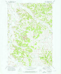
~ Wolf School MT topo map, 1:24000 scale, 7.5 X 7.5 Minute, Historical, 1972, updated 1976
Wolf School, Montana, USGS topographic map dated 1972.
Includes geographic coordinates (latitude and longitude). This topographic map is suitable for hiking, camping, and exploring, or framing it as a wall map.
Printed on-demand using high resolution imagery, on heavy weight and acid free paper, or alternatively on a variety of synthetic materials.
Topos available on paper, Waterproof, Poly, or Tyvek. Usually shipping rolled, unless combined with other folded maps in one order.
- Product Number: USGS-5400488
- Free digital map download (high-resolution, GeoPDF): Wolf School, Montana (file size: 12 MB)
- Map Size: please refer to the dimensions of the GeoPDF map above
- Weight (paper map): ca. 55 grams
- Map Type: POD USGS Topographic Map
- Map Series: HTMC
- Map Verison: Historical
- Cell ID: 49682
- Scan ID: 267695
- Imprint Year: 1976
- Woodland Tint: Yes
- Aerial Photo Year: 1971
- Field Check Year: 1972
- Datum: NAD27
- Map Projection: Lambert Conformal Conic
- Map published by United States Geological Survey
- Map Language: English
- Scanner Resolution: 600 dpi
- Map Cell Name: Wolf School
- Grid size: 7.5 X 7.5 Minute
- Date on map: 1972
- Map Scale: 1:24000
- Geographical region: Montana, United States
Neighboring Maps:
All neighboring USGS topo maps are available for sale online at a variety of scales.
Spatial coverage:
Topo map Wolf School, Montana, covers the geographical area associated the following places:
- 01N38E31CCCC01 Well - 01N38E32BACB01 Well - 01N38E32CDCB01 Well - 01N38E30DDBD02 Well - 01N38E30BCCC01 Spring - 01N37E26BDDD01 Well - 02N37E36CCCC01 Well - 01N38E29ADCA01 Well - 01N37E34DACB01 Well - 01N37E21ACDD01 Well - 01N37E36BDAD03 Well - 01S37E01BAAD02 Well - 01N38E19CBBB03 Well - 01N37E36BDAD02 Well - 01S38E09CAAA01 Well - 01N38E18DCCD01 Spring - 01N38E08ADBD01 Well - 01N38E18ACAB01 Spring - 01S38E09CAAA02 Well - 01N37E24DADD01 Spring - 01N38E31DACA03 Well - 01N38E19BDDB01 Spring - 01N37E27BDCB01 Well - 01N37E16ACCC02 Spring - 01N38E29BBBD03 Well - 01N38E19CBBB01 Well - 01S38E09BDDA01 Well - 01N38E19CBBB02 Well - 01N37E24CADB01 Well - 01N38E05ADCD01 Spring - 01N38E30BBBA01 Spring - 02N37E34DCAB01 Well - 01N37E16ACCC01 Well - 01N38E04DCCD01 Well - 01N38E19BCDC01 Spring - 01N37E15BBCA01 Well - 01N38E30AAAD03 Well - Middle Fork Spring Creek - 02N37E35CDCC01 Well - 01N37E12ACDC01 Spring - 01N37E36BDCA01 Spring - 01N38E32BAAB01 Well - Wolf School (historical) - 01N37E13CABB01 Well - 01N38E19BCCC01 Well - 01S37E01DACC01 Spring - 01S37E01BAAD01 Well - 01N37E25BCBD01 Well - 01N37E26DAAB01 Spring - 01N38E19DCDB01 Spring - 01N38E19CDDB01 Well - 01N37E13CABB02 Well - 01N38E29BBBD02 Well - 01N37E13ACAB01 Well - 01N37E25BCAC01 Spring - 01N38E09BADD01 Well - 01N38E20BDAC01 Well - 02N37E33DCBB01 Well - 01S38E05DDB_01 Well - 01N37E16DDDD02 Spring - 01N37E15BBBA01 Well - 01N38E05DBAD01 Well - 01N37E24CACA01 Well - 01S37E02CDBC01 Well - 01N38E30DDBB01 Well - 01N38E30DDAD01 Well - 01S38E09BADD01 Well - 01N38E30AAAD01 Well - 01N38E29DBBB01 Spring - 01N38E18ABAB01 Spring - 01N37E35CBCB01 Well - 01N38E29ADDA01 Well - 01S38E09ACBB01 Well - 01N37E34DACB02 Well - 01N38E30AAAD02 Well - 01N38E29CABD01 Well - 01N38E30DDBB03 Well - 01N38E29ACDC01 Spring - 01N37E22CBCC01 Spring - 01N37E26AADA01 Spring - Spring Creek - 01N37E14ACCC01 Well - 01S38E11BCBC01 Well - 01S38E05DCAD01 Well - 01N38E08ADAC01 Well - 01N38E22CCCC01 Well - 01N37E02BAAA01 Well - 01N38E05DABC01 Well - 01N38E30BADB01 Spring - 01N37E04ACBB01 Well - 01N38E30DDBD01 Well - Kuehn - 01N37E36DBBB01 Spring - 01N38E22CCCC02 Well - 01N38E31DACA01 Well - 01N37E23DBCD01 Well - 01N37E03CDAB01 Well - 01N38E17CAAA01 Spring - 01N37E15BAAD01 Well - 01N38E29DBCC01 Spring
- Map Area ID: AREA45.87545.75-107.125-107
- Northwest corner Lat/Long code: USGSNW45.875-107.125
- Northeast corner Lat/Long code: USGSNE45.875-107
- Southwest corner Lat/Long code: USGSSW45.75-107.125
- Southeast corner Lat/Long code: USGSSE45.75-107
- Northern map edge Latitude: 45.875
- Southern map edge Latitude: 45.75
- Western map edge Longitude: -107.125
- Eastern map edge Longitude: -107


