
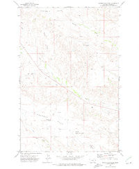
~ Poverty Flat East MT topo map, 1:24000 scale, 7.5 X 7.5 Minute, Historical, 1972, updated 1975
Poverty Flat East, Montana, USGS topographic map dated 1972.
Includes geographic coordinates (latitude and longitude). This topographic map is suitable for hiking, camping, and exploring, or framing it as a wall map.
Printed on-demand using high resolution imagery, on heavy weight and acid free paper, or alternatively on a variety of synthetic materials.
Topos available on paper, Waterproof, Poly, or Tyvek. Usually shipping rolled, unless combined with other folded maps in one order.
- Product Number: USGS-5397756
- Free digital map download (high-resolution, GeoPDF): Poverty Flat East, Montana (file size: 9 MB)
- Map Size: please refer to the dimensions of the GeoPDF map above
- Weight (paper map): ca. 55 grams
- Map Type: POD USGS Topographic Map
- Map Series: HTMC
- Map Verison: Historical
- Cell ID: 71292
- Scan ID: 266130
- Imprint Year: 1975
- Woodland Tint: Yes
- Aerial Photo Year: 1970
- Field Check Year: 1972
- Datum: NAD27
- Map Projection: Lambert Conformal Conic
- Map published by United States Geological Survey
- Map Language: English
- Scanner Resolution: 600 dpi
- Map Cell Name: Poverty Flat East
- Grid size: 7.5 X 7.5 Minute
- Date on map: 1972
- Map Scale: 1:24000
- Geographical region: Montana, United States
Neighboring Maps:
All neighboring USGS topo maps are available for sale online at a variety of scales.
Spatial coverage:
Topo map Poverty Flat East, Montana, covers the geographical area associated the following places:
- Gampost Mine - 17N54E29ACDB01 Well - 17N54E11DBCC01 Well - Lower Threemile School (historical) - 16N54E14ADAD01 Well - 16N55E09BBBC01 Well - 17N54E14ADBC01 Well - D Bar Coulee - 17N55E30DACC01 Well - 17N54E20CCBA01 Well - Dawson Community Airport - 16N54E12CBDB01 Well - 17N55E30CC__01 Well - Glendive Butte - Wolf Point School (historical) - Poverty Flat School (historical) - 17N54E17ACAB01 Well
- Map Area ID: AREA47.2547.125-104.875-104.75
- Northwest corner Lat/Long code: USGSNW47.25-104.875
- Northeast corner Lat/Long code: USGSNE47.25-104.75
- Southwest corner Lat/Long code: USGSSW47.125-104.875
- Southeast corner Lat/Long code: USGSSE47.125-104.75
- Northern map edge Latitude: 47.25
- Southern map edge Latitude: 47.125
- Western map edge Longitude: -104.875
- Eastern map edge Longitude: -104.75


