
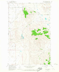
~ Markle Pass MT topo map, 1:24000 scale, 7.5 X 7.5 Minute, Historical, 1964, updated 1967
Markle Pass, Montana, USGS topographic map dated 1964.
Includes geographic coordinates (latitude and longitude). This topographic map is suitable for hiking, camping, and exploring, or framing it as a wall map.
Printed on-demand using high resolution imagery, on heavy weight and acid free paper, or alternatively on a variety of synthetic materials.
Topos available on paper, Waterproof, Poly, or Tyvek. Usually shipping rolled, unless combined with other folded maps in one order.
- Product Number: USGS-5396254
- Free digital map download (high-resolution, GeoPDF): Markle Pass, Montana (file size: 10 MB)
- Map Size: please refer to the dimensions of the GeoPDF map above
- Weight (paper map): ca. 55 grams
- Map Type: POD USGS Topographic Map
- Map Series: HTMC
- Map Verison: Historical
- Cell ID: 27757
- Scan ID: 265243
- Imprint Year: 1967
- Woodland Tint: Yes
- Aerial Photo Year: 1963
- Field Check Year: 1964
- Datum: NAD27
- Map Projection: Polyconic
- Map published by United States Geological Survey
- Map Language: English
- Scanner Resolution: 600 dpi
- Map Cell Name: Markle Pass
- Grid size: 7.5 X 7.5 Minute
- Date on map: 1964
- Map Scale: 1:24000
- Geographical region: Montana, United States
Neighboring Maps:
All neighboring USGS topo maps are available for sale online at a variety of scales.
Spatial coverage:
Topo map Markle Pass, Montana, covers the geographical area associated the following places:
- 22N23W33DDA_01 Well - Christensen Dam - 21N23W11CBD_01 Well - 21N23W02DBB_01 Well - Dry Fork Creek - Garden Creek - Hot Springs District - 21N23W03DBAC01 Well - Schmitz Lakes - 21N23W04DAAC01 Well - 21N23W14ACB_01 Well - 21N24W10AADD01 Well - 21N23W14ACD_01 Well - Markle Pass - 21N24W12CCC_01 Well - 21N23W11CACC01 Well - 21N23W03DBB_01 Well - 20N24W02CCD_01 Well - 20N24W11AADC01 Well - 21N23W10BDD_01 Well - Warm Springs Creek - Markle Cemetery - Wilks Gulch - Hot Springs Airport - 21N24W01CAD_01 Well - Schmitz Mountain - 21N24W12ADD_01 Well - 21N23W04AAD_01 Well - Cottonwood Creek - 21N24W24BAC_01 Well - 20N24W01DCCD01 Well - 22N23W33DDC_01 Well - 20N24W01CCB_01 Well - Oliver Gulch School (historical) - 21N24W12CCC_02 Well - 22N23W33DAD_01 Well - 20N24W12CCA_01 Well - Hot Springs Creek - Cross Dam - 21N24W01ABB_01 Well
- Map Area ID: AREA47.62547.5-114.625-114.5
- Northwest corner Lat/Long code: USGSNW47.625-114.625
- Northeast corner Lat/Long code: USGSNE47.625-114.5
- Southwest corner Lat/Long code: USGSSW47.5-114.625
- Southeast corner Lat/Long code: USGSSE47.5-114.5
- Northern map edge Latitude: 47.625
- Southern map edge Latitude: 47.5
- Western map edge Longitude: -114.625
- Eastern map edge Longitude: -114.5


