
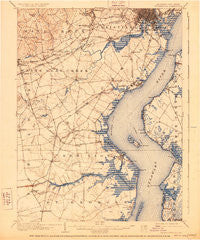
~ Wilmington DE topo map, 1:62500 scale, 15 X 15 Minute, Historical, 1906, updated 1928
Wilmington, Delaware, USGS topographic map dated 1906.
Includes geographic coordinates (latitude and longitude). This topographic map is suitable for hiking, camping, and exploring, or framing it as a wall map.
Printed on-demand using high resolution imagery, on heavy weight and acid free paper, or alternatively on a variety of synthetic materials.
Topos available on paper, Waterproof, Poly, or Tyvek. Usually shipping rolled, unless combined with other folded maps in one order.
- Product Number: USGS-5390374
- Free digital map download (high-resolution, GeoPDF): Wilmington, Delaware (file size: 8 MB)
- Map Size: please refer to the dimensions of the GeoPDF map above
- Weight (paper map): ca. 55 grams
- Map Type: POD USGS Topographic Map
- Map Series: HTMC
- Map Verison: Historical
- Cell ID: 64586
- Scan ID: 255803
- Imprint Year: 1928
- Survey Year: 1904
- Datum: NAD
- Map Projection: Polyconic
- Map published by United States Geological Survey
- Map Language: English
- Scanner Resolution: 600 dpi
- Map Cell Name: Wilmington
- Grid size: 15 X 15 Minute
- Date on map: 1906
- Map Scale: 1:62500
- Geographical region: Delaware, United States
Neighboring Maps:
All neighboring USGS topo maps are available for sale online at a variety of scales.
Spatial coverage:
Topo map Wilmington, Delaware, covers the geographical area associated the following places:
- Linden Green Apartment - Boyds Corner - Carousel Knoll - Pigeon Run - Bear - Scarborough Park - Redmont - Alban Park - Harmony Hills - Caravel Farms - Port Penn - Glasgow - Corner Ketch - Brookhaven - Glasgow Pines - Ashley Heights - Raintree Village - Edgebrooke - Church Landing - Manette Heights - Llangollen Estates - Overview Gardens - The Cedars - Cranston Heights - Marshallton Green - Newport Heights - Marshallton - Oakmont - Brookmont Farms - Tolham Estates - Limestone Gardene - Delaware City - Carriage Run - Pencader - Elmhurst - Mount Pleasant - Stratford - Greenbridge - Jamisons Corner - Belmoor - Eden Park Gardens - Dunlinden Acres - Woodshade - Catalina Gardens - Faulkland Woods - Saint Georges Heights - Fredericks Addition - Williamsburg - Monterey Farms - Swanwyck Estates - Pencader Village - Oakdale - Garfield Park - Chapel Hill - Hillside Heights - Harmony - Washington Heights - Delpark Manor - Deacons Walk - Wilmington - Forest Park - Chestnut Hill Estates - Mermaid - Corbit - Melody Meadows - Liberty - Saienni Farms - Yorkshire - Eastburn Farms - Birds Corner - Kings Croft - Rose Hill Gardens - Brandywine Springs Manor - The Pines of Pike Creek - Shenandoah - Green Valley - West Meadow - English Village - Varlano - The Highlands - Westfield - Kiamensi - Stanton Estates - Middleboro Manor - Midvale - Mermaid Run - Washington Park - Stony Crest - Manor Park Apartments - Wedgewood - Rolling Hills - Pennsville - Greenbridge - East Minquadale - Cavaliers Country Club Apartments - Belvidere - Keystone - Tybouts Corner - Clearfield - Duncan Woods
- Map Area ID: AREA39.7539.5-75.75-75.5
- Northwest corner Lat/Long code: USGSNW39.75-75.75
- Northeast corner Lat/Long code: USGSNE39.75-75.5
- Southwest corner Lat/Long code: USGSSW39.5-75.75
- Southeast corner Lat/Long code: USGSSE39.5-75.5
- Northern map edge Latitude: 39.75
- Southern map edge Latitude: 39.5
- Western map edge Longitude: -75.75
- Eastern map edge Longitude: -75.5


