
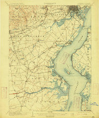
~ Wilmington DE topo map, 1:62500 scale, 15 X 15 Minute, Historical, 1906, updated 1915
Wilmington, Delaware, USGS topographic map dated 1906.
Includes geographic coordinates (latitude and longitude). This topographic map is suitable for hiking, camping, and exploring, or framing it as a wall map.
Printed on-demand using high resolution imagery, on heavy weight and acid free paper, or alternatively on a variety of synthetic materials.
Topos available on paper, Waterproof, Poly, or Tyvek. Usually shipping rolled, unless combined with other folded maps in one order.
- Product Number: USGS-5390370
- Free digital map download (high-resolution, GeoPDF): Wilmington, Delaware (file size: 8 MB)
- Map Size: please refer to the dimensions of the GeoPDF map above
- Weight (paper map): ca. 55 grams
- Map Type: POD USGS Topographic Map
- Map Series: HTMC
- Map Verison: Historical
- Cell ID: 64586
- Scan ID: 255801
- Imprint Year: 1915
- Survey Year: 1904
- Datum: Unstated
- Map Projection: Unstated
- Map published by United States Geological Survey
- Map Language: English
- Scanner Resolution: 600 dpi
- Map Cell Name: Wilmington
- Grid size: 15 X 15 Minute
- Date on map: 1906
- Map Scale: 1:62500
- Geographical region: Delaware, United States
Neighboring Maps:
All neighboring USGS topo maps are available for sale online at a variety of scales.
Spatial coverage:
Topo map Wilmington, Delaware, covers the geographical area associated the following places:
- Overview Gardens - Tolham Estates - Penns Beach - Greenbank - Masonicville - Milford Meadows - Duncan Glen - Ashley Heights - Linden Square - Kirkwood Gardens - Pennock - Hillside Heights - Dragon Run Terrace Mobile Home Park - Sherwood Forest - Tybouts Corner - Christiana Village - Pendrew Manor - Linden Hill - Coventry - Limestone Acres - Stanton - Glasgow Pines - Moores Acres - Ruthby - Stones Throw - Windy Hills - Wood Wards Addition - Christiana Acres - Princeton Wood II - Port Penn - Woodcrest - Marshallton - Birds Corner - Eastburn Acres - Wellington Woods - Windy Mill Park - Hares Corner - Greenleaf Manor - Bestfield - Heather Woods - Duross Heights - Minquadale - West Meadow - Limestone Gap - Rivers End - Summer Hill - Albertson - Swanwyck Gardens - Marydale - Prices Corner - Faulkland Woods - Albertson Park - Pendrew Manor - Porter Square - Hyde Park - Wedgewood - Montclare - Marabou Meadows - English Village - Manette Heights - Salem Woods - Todd Estates - Iron Hills Apartments - Belmoor - Duncan Village - Henderson Heights - Lindell Square - The Villa - Glendale - Melody Meadows II - Chestnut Hill Estates - Oak Hollow - Churchtown - Meadowbrook Farms South - Crystal Run Farm - Red Lion - Mount Pleasant Mobile Home Park - Pigeon Run - Parkside - The Pines of Pike Creek - Woodside Manor - Arbor Pointe Apartments - Brandywine Springs Manor - Claridge Court - Limestone Gardene - Willow Run - Woodcreek - Elmwood - Clay Acres - Albion - Sheridan Square - Klair Estate - Lumbrook - Catalina Gardens - Wrange Hill Estates - Grendon Farms - Shenandoah - Brookland Terrace - Bayview Manor - Woodland
- Map Area ID: AREA39.7539.5-75.75-75.5
- Northwest corner Lat/Long code: USGSNW39.75-75.75
- Northeast corner Lat/Long code: USGSNE39.75-75.5
- Southwest corner Lat/Long code: USGSSW39.5-75.75
- Southeast corner Lat/Long code: USGSSE39.5-75.5
- Northern map edge Latitude: 39.75
- Southern map edge Latitude: 39.5
- Western map edge Longitude: -75.75
- Eastern map edge Longitude: -75.5


