
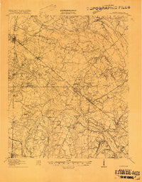
~ Varnville SC topo map, 1:62500 scale, 15 X 15 Minute, Historical, 1918
Varnville, South Carolina, USGS topographic map dated 1918.
Includes geographic coordinates (latitude and longitude). This topographic map is suitable for hiking, camping, and exploring, or framing it as a wall map.
Printed on-demand using high resolution imagery, on heavy weight and acid free paper, or alternatively on a variety of synthetic materials.
Topos available on paper, Waterproof, Poly, or Tyvek. Usually shipping rolled, unless combined with other folded maps in one order.
- Product Number: USGS-5388992
- Free digital map download (high-resolution, GeoPDF): Varnville, South Carolina (file size: 9 MB)
- Map Size: please refer to the dimensions of the GeoPDF map above
- Weight (paper map): ca. 55 grams
- Map Type: POD USGS Topographic Map
- Map Series: HTMC
- Map Verison: Historical
- Cell ID: 64053
- Scan ID: 261966
- Visual Version Number: 1
- Survey Year: 1918
- Datum: Unstated
- Map Projection: Unstated
- Advance: Yes
- Map published by United States Army Corps of Engineers
- Map published by United States Department of War
- Keywords: Nonstandard Press Run
- Map Language: English
- Scanner Resolution: 600 dpi
- Map Cell Name: Varnville
- Grid size: 15 X 15 Minute
- Date on map: 1918
- Map Scale: 1:62500
- Geographical region: South Carolina, United States
Neighboring Maps:
All neighboring USGS topo maps are available for sale online at a variety of scales.
Spatial coverage:
Topo map Varnville, South Carolina, covers the geographical area associated the following places:
- Varnville - Fairfax - Almeda - Brunson - Estill - Luray - Speaks Mill - Pond Town - Miley - Hickory Hill (historical) - Hampton - Camp Branch - Lena - Gifford - Moselle - Cleland Crossroads - Richardson Crossroads - Dukes - Crocketville - Halls Mill
- Map Area ID: AREA3332.75-81.25-81
- Northwest corner Lat/Long code: USGSNW33-81.25
- Northeast corner Lat/Long code: USGSNE33-81
- Southwest corner Lat/Long code: USGSSW32.75-81.25
- Southeast corner Lat/Long code: USGSSE32.75-81
- Northern map edge Latitude: 33
- Southern map edge Latitude: 32.75
- Western map edge Longitude: -81.25
- Eastern map edge Longitude: -81


