
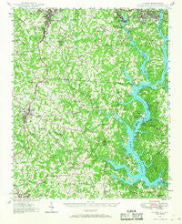
~ Clover SC topo map, 1:62500 scale, 15 X 15 Minute, Historical, 1947, updated 1968
Clover, South Carolina, USGS topographic map dated 1947.
Includes geographic coordinates (latitude and longitude). This topographic map is suitable for hiking, camping, and exploring, or framing it as a wall map.
Printed on-demand using high resolution imagery, on heavy weight and acid free paper, or alternatively on a variety of synthetic materials.
Topos available on paper, Waterproof, Poly, or Tyvek. Usually shipping rolled, unless combined with other folded maps in one order.
- Product Number: USGS-5388696
- Free digital map download (high-resolution, GeoPDF): Clover, South Carolina (file size: 10 MB)
- Map Size: please refer to the dimensions of the GeoPDF map above
- Weight (paper map): ca. 55 grams
- Map Type: POD USGS Topographic Map
- Map Series: HTMC
- Map Verison: Historical
- Cell ID: 52711
- Scan ID: 261809
- Imprint Year: 1968
- Woodland Tint: Yes
- Aerial Photo Year: 1941
- Survey Year: 1947
- Datum: NAD27
- Map Projection: Polyconic
- Map published by United States Geological Survey
- Map Language: English
- Scanner Resolution: 600 dpi
- Map Cell Name: Clover
- Grid size: 15 X 15 Minute
- Date on map: 1947
- Map Scale: 1:62500
- Geographical region: South Carolina, United States
Neighboring Maps:
All neighboring USGS topo maps are available for sale online at a variety of scales.
Spatial coverage:
Topo map Clover, South Carolina, covers the geographical area associated the following places:
- Crowders (historical) - River Pines - Boogertown - Lakewood - South Gastonia - River Hills Plantation - Monticello Woods - Timber Ridge - Poplar Acres - Sunrise Point - Lakewood Acres - India Hook - Wesley Park - Catawba Ridge - Clover - Forest Acres - Honeysuckle Woods - Hickory Hill - Begonia (historical) - Paradise Point - Fairway Bridge - Forest Brook - Tega Cay - Blackwood Park - Pine Harbor - Hollyberry Woods - Bowling Green - Oakwood - Gardner Wood - Concord - Cramerton - Crowders - Belmont (historical) - Five Points - Elmores Crossroads - Belmont - Fallcrest - Bethel (historical) - Lake Wood - English Gardens - Lincoln Estates - Cramer Mountain - Lakewood - South Point - Cedarwood - Island View Landing - Yorkwood - Heritage Woods - Lake Wylie - Catawba (historical) - South Belmont
- Map Area ID: AREA35.2535-81.25-81
- Northwest corner Lat/Long code: USGSNW35.25-81.25
- Northeast corner Lat/Long code: USGSNE35.25-81
- Southwest corner Lat/Long code: USGSSW35-81.25
- Southeast corner Lat/Long code: USGSSE35-81
- Northern map edge Latitude: 35.25
- Southern map edge Latitude: 35
- Western map edge Longitude: -81.25
- Eastern map edge Longitude: -81


