
~ Albuquerque NM topo map, 1:125000 scale, 30 X 30 Minute, Historical, 1889
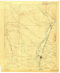
Albuquerque, New Mexico, USGS topographic map dated 1889.
Includes geographic coordinates (latitude and longitude). This topographic map is suitable for hiking, camping, and exploring, or framing it as a wall map.
Printed on-demand using high resolution imagery, on heavy weight and acid free paper, or alternatively on a variety of synthetic materials.
Topos available on paper, Waterproof, Poly, or Tyvek. Usually shipping rolled, unless combined with other folded maps in one order.
- Product Number: USGS-5386202
- Free digital map download (high-resolution, GeoPDF): Albuquerque, New Mexico (file size: 6 MB)
- Map Size: please refer to the dimensions of the GeoPDF map above
- Weight (paper map): ca. 55 grams
- Map Type: POD USGS Topographic Map
- Map Series: HTMC
- Map Verison: Historical
- Cell ID: 64987
- Scan ID: 189271
- Survey Year: 1888
- Datum: Unstated
- Map Projection: Unstated
- Map published by United States Geological Survey
- Map Language: English
- Scanner Resolution: 600 dpi
- Map Cell Name: Bernalillo
- Grid size: 30 X 30 Minute
- Date on map: 1889
- Map Scale: 1:125000
- Geographical region: New Mexico, United States
Neighboring Maps:
All neighboring USGS topo maps are available for sale online at a variety of scales.
Spatial coverage:
Topo map Albuquerque, New Mexico, covers the geographical area associated the following places:
- Armijo - Chelwood Park - Chical - Rio Rancho - Paradise Hills - El Chapparal - Cañada Village - San Jose - Kirtland Addition - Buena Ventura - Corrales - Lee Acres - Desert Mountain - La Cuesta - North Valley - Kinney - South Valley - Sandia Vista - Los Ranchos de Albuquerque - Vista Encantada - Old Town - Arenal - Albuquerque - Rio Rancho Estates - Atrisco - Anasazi Trails - El Llanito - Fruitvale (historical) - Mesa Village - Pueblo of Sandia Village - Santa Ana Pueblo - Rivajana - Los Griegos - Ranchito - Five Points - Martinez Town - Los Candelarias - Barelas - Hoffmantown - Las Cocinitas (historical) - Sandia Pueblo - Los Duranes - Bernalillo - Alameda - Taylor Ranch - Hahn
- Map Area ID: AREA35.535-107-106.5
- Northwest corner Lat/Long code: USGSNW35.5-107
- Northeast corner Lat/Long code: USGSNE35.5-106.5
- Southwest corner Lat/Long code: USGSSW35-107
- Southeast corner Lat/Long code: USGSSE35-106.5
- Northern map edge Latitude: 35.5
- Southern map edge Latitude: 35
- Western map edge Longitude: -107
- Eastern map edge Longitude: -106.5


