
~ Hat Mesa NM topo map, 1:62500 scale, 15 X 15 Minute, Historical, 1963, updated 1974
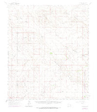
Hat Mesa, New Mexico, USGS topographic map dated 1963.
Includes geographic coordinates (latitude and longitude). This topographic map is suitable for hiking, camping, and exploring, or framing it as a wall map.
Printed on-demand using high resolution imagery, on heavy weight and acid free paper, or alternatively on a variety of synthetic materials.
Topos available on paper, Waterproof, Poly, or Tyvek. Usually shipping rolled, unless combined with other folded maps in one order.
- Product Number: USGS-5385606
- Free digital map download (high-resolution, GeoPDF): Hat Mesa, New Mexico (file size: 5 MB)
- Map Size: please refer to the dimensions of the GeoPDF map above
- Weight (paper map): ca. 55 grams
- Map Type: POD USGS Topographic Map
- Map Series: HTMC
- Map Verison: Historical
- Cell ID: 55145
- Scan ID: 190876
- Imprint Year: 1974
- Woodland Tint: Yes
- Photo Revision Year: 1972
- Aerial Photo Year: 1972
- Datum: NAD27
- Map Projection: Polyconic
- Map published by United States Geological Survey
- Map Language: English
- Scanner Resolution: 600 dpi
- Map Cell Name: Hat Mesa
- Grid size: 15 X 15 Minute
- Date on map: 1963
- Map Scale: 1:62500
- Geographical region: New Mexico, United States
Neighboring Maps:
All neighboring USGS topo maps are available for sale online at a variety of scales.
Spatial coverage:
Topo map Hat Mesa, New Mexico, covers the geographical area associated the following places:
- Comanche Wells - Triste Draw Oil Field - The Divide - School Section Tanks - Bell Lake Oil Field - Rockbottom Tank - Hayfield Tank - Clifton Well - Graham Well - Grama Ridge - 13593 Water Well - 13592 Water Well - Hat Mesa Gas Field - Cruz Oil Field - West Well - Standard Wells - San Simon Swale - Under the Hill Tank - Tip Top Wells - Lost Tank - 13595 Water Well - Rogers Well - Antelope Ridge - 13594 Water Well - Allred Well - Red Tank - Brimminstool Ranch - Dagger Lake - Airport Pit ID Number 2901648 - Divide Tank - Hat Mesa - Bootleg Ridge - Sand Dunes Oil Field - Bilbrey Basin - Eaves Wells
- Map Area ID: AREA32.532.25-103.75-103.5
- Northwest corner Lat/Long code: USGSNW32.5-103.75
- Northeast corner Lat/Long code: USGSNE32.5-103.5
- Southwest corner Lat/Long code: USGSSW32.25-103.75
- Southeast corner Lat/Long code: USGSSE32.25-103.5
- Northern map edge Latitude: 32.5
- Southern map edge Latitude: 32.25
- Western map edge Longitude: -103.75
- Eastern map edge Longitude: -103.5


