
~ Chicken Well NM topo map, 1:62500 scale, 15 X 15 Minute, Historical, 1948, updated 1954
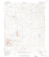
Chicken Well, New Mexico, USGS topographic map dated 1948.
Includes geographic coordinates (latitude and longitude). This topographic map is suitable for hiking, camping, and exploring, or framing it as a wall map.
Printed on-demand using high resolution imagery, on heavy weight and acid free paper, or alternatively on a variety of synthetic materials.
Topos available on paper, Waterproof, Poly, or Tyvek. Usually shipping rolled, unless combined with other folded maps in one order.
- Product Number: USGS-5385452
- Free digital map download (high-resolution, GeoPDF): Chicken Well, New Mexico (file size: 6 MB)
- Map Size: please refer to the dimensions of the GeoPDF map above
- Weight (paper map): ca. 55 grams
- Map Type: POD USGS Topographic Map
- Map Series: HTMC
- Map Verison: Historical
- Cell ID: 52491
- Scan ID: 190149
- Imprint Year: 1954
- Aerial Photo Year: 1948
- Field Check Year: 1948
- Datum: NAD27
- Map Projection: Polyconic
- Map published by United States Army Corps of Engineers
- Map Language: English
- Scanner Resolution: 600 dpi
- Map Cell Name: Chicken Well
- Grid size: 15 X 15 Minute
- Date on map: 1948
- Map Scale: 1:62500
- Geographical region: New Mexico, United States
Neighboring Maps:
All neighboring USGS topo maps are available for sale online at a variety of scales.
Spatial coverage:
Topo map Chicken Well, New Mexico, covers the geographical area associated the following places:
- Upham Hills - Martin Tank - Broke Tank - Blackshire Draw - East Tank Number 3 - Lyons Tank - Rawls Farm - Renick Tank - Cox Tank - Aleman Ranch Headquarters - Renick Well - Flat Lake - Gilmore Draw - Broke Tank - Yoast Draw - House Pasture Windmill - Jornada Draw - Hidden Tank - Sand Hills Tanks - Aleman Draw - Lyons Tank - Pot Hole Tank - Chicken Well - Spaceport America - CCC Tank - Fleck Draw - Houge Tank - Flat Lake Ranch - New Tank - Point of Rocks - House Pasture Tank - Hille Ranch - Flat Lake Ranch - Prisor Well - Mose Tank - Turner Tank - Lyons Draw - Kacy Tank
- Map Area ID: AREA3332.75-107-106.75
- Northwest corner Lat/Long code: USGSNW33-107
- Northeast corner Lat/Long code: USGSNE33-106.75
- Southwest corner Lat/Long code: USGSSW32.75-107
- Southeast corner Lat/Long code: USGSSE32.75-106.75
- Northern map edge Latitude: 33
- Southern map edge Latitude: 32.75
- Western map edge Longitude: -107
- Eastern map edge Longitude: -106.75


