
~ Swallow Nest Canyon NM topo map, 1:24000 scale, 7.5 X 7.5 Minute, Historical, 1967, updated 1982
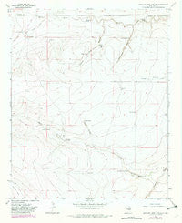
Swallow Nest Canyon, New Mexico, USGS topographic map dated 1967.
Includes geographic coordinates (latitude and longitude). This topographic map is suitable for hiking, camping, and exploring, or framing it as a wall map.
Printed on-demand using high resolution imagery, on heavy weight and acid free paper, or alternatively on a variety of synthetic materials.
Topos available on paper, Waterproof, Poly, or Tyvek. Usually shipping rolled, unless combined with other folded maps in one order.
- Product Number: USGS-5384204
- Free digital map download (high-resolution, GeoPDF): Swallow Nest Canyon, New Mexico (file size: 8 MB)
- Map Size: please refer to the dimensions of the GeoPDF map above
- Weight (paper map): ca. 55 grams
- Map Type: POD USGS Topographic Map
- Map Series: HTMC
- Map Verison: Historical
- Cell ID: 71769
- Scan ID: 193193
- Imprint Year: 1982
- Woodland Tint: Yes
- Photo Revision Year: 1982
- Aerial Photo Year: 1979
- Edit Year: 1982
- Datum: NAD27
- Map Projection: Polyconic
- Map published by United States Geological Survey
- Map Language: English
- Scanner Resolution: 600 dpi
- Map Cell Name: Swallow Nest Canyon
- Grid size: 7.5 X 7.5 Minute
- Date on map: 1967
- Map Scale: 1:24000
- Geographical region: New Mexico, United States
Neighboring Maps:
All neighboring USGS topo maps are available for sale online at a variety of scales.
Spatial coverage:
Topo map Swallow Nest Canyon, New Mexico, covers the geographical area associated the following places:
- Rattlesnake Canyon - Wyly Well - Horse Creek Well - Rattlesnake Spring - Coyote Canyon - Highwater Well - Swallow Nest Canyon - 10731 Water Well - Horse Creek - North Tank - Camack Well - 10727 Water Well - 10728 Water Well - South Wylie Draw - School Section Well - Coyote Spring - 10730 Water Well - Lower Horse Creek Spring - Cavel School - 10729 Water Well - Redman Tank - 10723 Water Well - Sacra Ranch - Drake Tank - Blue Hole Spring - Cottonwood Well - Headwater Spring - Drager Well - Deep Well - 10382 Water Well - Horse Creek Spring
- Map Area ID: AREA3433.875-104.5-104.375
- Northwest corner Lat/Long code: USGSNW34-104.5
- Northeast corner Lat/Long code: USGSNE34-104.375
- Southwest corner Lat/Long code: USGSSW33.875-104.5
- Southeast corner Lat/Long code: USGSSE33.875-104.375
- Northern map edge Latitude: 34
- Southern map edge Latitude: 33.875
- Western map edge Longitude: -104.5
- Eastern map edge Longitude: -104.375


