
~ Gym Peak NM topo map, 1:24000 scale, 7.5 X 7.5 Minute, Historical, 1964, updated 1986
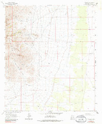
Gym Peak, New Mexico, USGS topographic map dated 1964.
Includes geographic coordinates (latitude and longitude). This topographic map is suitable for hiking, camping, and exploring, or framing it as a wall map.
Printed on-demand using high resolution imagery, on heavy weight and acid free paper, or alternatively on a variety of synthetic materials.
Topos available on paper, Waterproof, Poly, or Tyvek. Usually shipping rolled, unless combined with other folded maps in one order.
- Product Number: USGS-5380588
- Free digital map download (high-resolution, GeoPDF): Gym Peak, New Mexico (file size: 9 MB)
- Map Size: please refer to the dimensions of the GeoPDF map above
- Weight (paper map): ca. 55 grams
- Map Type: POD USGS Topographic Map
- Map Series: HTMC
- Map Verison: Historical
- Cell ID: 18815
- Scan ID: 192815
- Imprint Year: 1986
- Woodland Tint: Yes
- Photo Inspection Year: 1976
- Aerial Photo Year: 1962
- Survey Year: 1964
- Datum: NAD27
- Map Projection: Polyconic
- Map published by United States Geological Survey
- Map Language: English
- Scanner Resolution: 600 dpi
- Map Cell Name: Gym Peak
- Grid size: 7.5 X 7.5 Minute
- Date on map: 1964
- Map Scale: 1:24000
- Geographical region: New Mexico, United States
Neighboring Maps:
All neighboring USGS topo maps are available for sale online at a variety of scales.
Spatial coverage:
Topo map Gym Peak, New Mexico, covers the geographical area associated the following places:
- Gym Peak - Silver Cave Number 1 - Copper Kettle Canyon - Priser Mine - White Dome Well - 00802 Water Well - Birchfield Zinc Prospect - 00800 Water Well - Waddell Prospect - 00805 Water Well - Victorio Canyon - Anniversary Mine - 00810 Water Well - 00809 Water Well - Baldy Peak - Box Canyon - Mahoney Mines - Lobo Draw - 00652 Water Well - Granada Mines - 00650 Water Well - Florida Mountains Wilderness Study Area - English Well - Silver Cave Mine - Lucky John - Birchfield Group-Florida Mountains Area - 00803 Water Well - Copper Ridge Mine - Copper Kettle Well - 01434 Water Well - Victorio Well - Florida Mountains - Blue Water Well - San-Tex Mine - Red Lake - 00648 Water Well - Atir Mine - Three Little Hills - Byer Spring - Florida Peak - Pacheco Mine - Victorio Draw
- Map Area ID: AREA32.12532-107.625-107.5
- Northwest corner Lat/Long code: USGSNW32.125-107.625
- Northeast corner Lat/Long code: USGSNE32.125-107.5
- Southwest corner Lat/Long code: USGSSW32-107.625
- Southeast corner Lat/Long code: USGSSE32-107.5
- Northern map edge Latitude: 32.125
- Southern map edge Latitude: 32
- Western map edge Longitude: -107.625
- Eastern map edge Longitude: -107.5


