
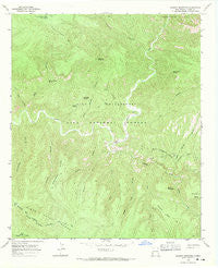
~ Granny Mountain NM topo map, 1:24000 scale, 7.5 X 7.5 Minute, Historical, 1965, updated 1970
Granny Mountain, New Mexico, USGS topographic map dated 1965.
Includes geographic coordinates (latitude and longitude). This topographic map is suitable for hiking, camping, and exploring, or framing it as a wall map.
Printed on-demand using high resolution imagery, on heavy weight and acid free paper, or alternatively on a variety of synthetic materials.
Topos available on paper, Waterproof, Poly, or Tyvek. Usually shipping rolled, unless combined with other folded maps in one order.
- Product Number: USGS-5380484
- Free digital map download (high-resolution, GeoPDF): Granny Mountain, New Mexico (file size: 14 MB)
- Map Size: please refer to the dimensions of the GeoPDF map above
- Weight (paper map): ca. 55 grams
- Map Type: POD USGS Topographic Map
- Map Series: HTMC
- Map Verison: Historical
- Cell ID: 18094
- Scan ID: 190814
- Imprint Year: 1970
- Woodland Tint: Yes
- Aerial Photo Year: 1964
- Field Check Year: 1965
- Datum: NAD27
- Map Projection: Polyconic
- Map published by United States Geological Survey
- Map Language: English
- Scanner Resolution: 600 dpi
- Map Cell Name: Granny Mountain
- Grid size: 7.5 X 7.5 Minute
- Date on map: 1965
- Map Scale: 1:24000
- Geographical region: New Mexico, United States
Neighboring Maps:
All neighboring USGS topo maps are available for sale online at a variety of scales.
Spatial coverage:
Topo map Granny Mountain, New Mexico, covers the geographical area associated the following places:
- Trout Creek - Sheep Corral Canyon - Panther Canyon - Water Canyon - Fall Canyon - Grapevine Spring - Panther Tank - Cow Creek - Monument Ridge - Maverick Mesa - Goose Lake Ridge - Johnson Canyon - Sycamore Canyon - Bull Spring - West Fork Snow Creek - West Canyon - Miller Spring - Sapillo Creek - Snow Creek - Water Canyon Spring - Shady Bend Spring - Spring Canyon Trail - Trap Tank - Rock Spring - Lower Spring Canyon - Paradise Tank - Granny Mountain Trail - Granny Mountain - Monument Tank - Miller Spring Cabin - Sapillo Trail - Pelican Spring - Point Tank - Pinos Altos Division - Farm Flat - Goose Lake - Horse Mountain Tank - Horse Mountain - Seep Spring Canyon
- Map Area ID: AREA33.12533-108.375-108.25
- Northwest corner Lat/Long code: USGSNW33.125-108.375
- Northeast corner Lat/Long code: USGSNE33.125-108.25
- Southwest corner Lat/Long code: USGSSW33-108.375
- Southeast corner Lat/Long code: USGSSE33-108.25
- Northern map edge Latitude: 33.125
- Southern map edge Latitude: 33
- Western map edge Longitude: -108.375
- Eastern map edge Longitude: -108.25


