
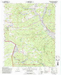
~ Burned Mountain NM topo map, 1:24000 scale, 7.5 X 7.5 Minute, Historical, 1995, updated 1997
Burned Mountain, New Mexico, USGS topographic map dated 1995.
Includes geographic coordinates (latitude and longitude). This topographic map is suitable for hiking, camping, and exploring, or framing it as a wall map.
Printed on-demand using high resolution imagery, on heavy weight and acid free paper, or alternatively on a variety of synthetic materials.
Topos available on paper, Waterproof, Poly, or Tyvek. Usually shipping rolled, unless combined with other folded maps in one order.
- Product Number: USGS-5378580
- Free digital map download (high-resolution, GeoPDF): Burned Mountain, New Mexico (file size: 13 MB)
- Map Size: please refer to the dimensions of the GeoPDF map above
- Weight (paper map): ca. 55 grams
- Map Type: POD USGS Topographic Map
- Map Series: HTMC
- Map Verison: Historical
- Cell ID: 6290
- Scan ID: 193866
- Imprint Year: 1997
- Woodland Tint: Yes
- Aerial Photo Year: 1990
- Field Check Year: 1995
- Datum: NAD27
- Map Projection: Transverse Mercator
- Map published by United States Forest Service
- Map Language: English
- Scanner Resolution: 600 dpi
- Map Cell Name: Burned Mountain
- Grid size: 7.5 X 7.5 Minute
- Date on map: 1995
- Map Scale: 1:24000
- Geographical region: New Mexico, United States
Neighboring Maps:
All neighboring USGS topo maps are available for sale online at a variety of scales.
Spatial coverage:
Topo map Burned Mountain, New Mexico, covers the geographical area associated the following places:
- Roybals Tank - El Vallecito Ranch - Cañada Jarosita - Middle Canyon - Snow Course Tank - Turkey Lake - Whale - King Richard Prospect - Deer Park Tank - Tusas Ridge - Spring Creek Tank - Jawbone Mine - Sullivan Tank - Sardine - Midnight Mine - Jim Jim Prospect - Beehive Tank - Espinosa Tank - Middle Canyon Tank - Sullivan Park - Hopewell Ridge - J O L - Union Lode - Ten Better Group Mine - Hoover Number 3 Mine - Miners Tank - Inner Mountain Prospect - Last Hope Claim - Whale Group Mine - War Eagle Prospect - Moeller Tank - Jumbo Prospect - Hornet Group Mine - Espinosa Canyon - Horseshoe Claim - Moeller Spring - Duran Tank - Royal Tank - Tusas Uranium Prospects - Kay Tee Prospect - Hoover Number 2 Mine - Hopewell Lake Campground - Willow Tank - Asiatic Group - Maquinita Canyon - Independence Claim - Amos Tank - Willow Gulch - Bone Ranch - Snow Flake Prospect - Sunrise Prospect - Butterfly Spring - Deer Park - Walker Prospect - Black Hawk Claim - Quartzite Peak - Duran Canyon - Rock Creek - Rubicon Prospect - Mary Elizabeth Prospect - Loyd Tank - Yolanda Spring - Hopewell Dam - Burned Mountain Tank - Deer Trail Creek - Lower Flat Placer - Tusas Mountain - Black Copper Prospect - Rinker Lake - Hopewell Lake - Mary E Steele Mine - Deer Tank - Lexington Lode - Cunningham Tank - Juvinile Prospect - Schley Prospect - Placer Creek - Strawberry Mine - Silent Friend Group Mine - Ridge Tank - Jaroso Creek - Little Tusas Creek - Grant Corral - Royal Purple Group - Merrimac Group Mine - Jawbone Mountain - Southern Cross Prospect - Burned Mountain - Mayflower Group - Wedge Prospect - Hummer Prospect - Vallecitos Division - Buckhorn Canyon - Last Dollar Mine
- Map Area ID: AREA36.7536.625-106.25-106.125
- Northwest corner Lat/Long code: USGSNW36.75-106.25
- Northeast corner Lat/Long code: USGSNE36.75-106.125
- Southwest corner Lat/Long code: USGSSW36.625-106.25
- Southeast corner Lat/Long code: USGSSE36.625-106.125
- Northern map edge Latitude: 36.75
- Southern map edge Latitude: 36.625
- Western map edge Longitude: -106.25
- Eastern map edge Longitude: -106.125


