
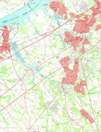
~ Woodbury NJ topo map, 1:24000 scale, 7.5 X 7.5 Minute, Historical, 1967, updated 1969
Woodbury, New Jersey, USGS topographic map dated 1967.
Includes geographic coordinates (latitude and longitude). This topographic map is suitable for hiking, camping, and exploring, or framing it as a wall map.
Printed on-demand using high resolution imagery, on heavy weight and acid free paper, or alternatively on a variety of synthetic materials.
Topos available on paper, Waterproof, Poly, or Tyvek. Usually shipping rolled, unless combined with other folded maps in one order.
- Product Number: USGS-5376924
- Free digital map download (high-resolution, GeoPDF): Woodbury, New Jersey (file size: 9 MB)
- Map Size: please refer to the dimensions of the GeoPDF map above
- Weight (paper map): ca. 55 grams
- Map Type: POD USGS Topographic Map
- Map Series: HTMC
- Map Verison: Historical
- Cell ID: 49747
- Scan ID: 255006
- Imprint Year: 1969
- Woodland Tint: Yes
- Aerial Photo Year: 1965
- Field Check Year: 1967
- Datum: NAD27
- Map Projection: Polyconic
- Map published by United States Geological Survey
- Map published by United States Department of Commerce
- Map Language: English
- Scanner Resolution: 600 dpi
- Map Cell Name: Woodbury
- Grid size: 7.5 X 7.5 Minute
- Date on map: 1967
- Map Scale: 1:24000
- Geographical region: New Jersey, United States
Neighboring Maps:
All neighboring USGS topo maps are available for sale online at a variety of scales.
Spatial coverage:
Topo map Woodbury, New Jersey, covers the geographical area associated the following places:
- Mantua - Buckingham Village - Friars Landing - Red Bank - Leonards - Mount Royal - Woodbury Heights - White Swan Mobile Home Park - Ogden - Barnsboro - Woodbury - Woodbury Gardens - Thorofare - Clarksboro - Billingsport - Verga - Colonial Manor - Sewell - Jericho - Paulsboro - South Westville - Riverwinds - Parkville - Westville - West End - Greenfield Heights - Sherwood West - Mantua Grove - Paradise - Jefferson - Wenonah - National Park - Green-Fields - Parkers Landing - New Sharon - Mickleton - North Woodbury - Centre City - Oak Valley
- Map Area ID: AREA39.87539.75-75.25-75.125
- Northwest corner Lat/Long code: USGSNW39.875-75.25
- Northeast corner Lat/Long code: USGSNE39.875-75.125
- Southwest corner Lat/Long code: USGSSW39.75-75.25
- Southeast corner Lat/Long code: USGSSE39.75-75.125
- Northern map edge Latitude: 39.875
- Southern map edge Latitude: 39.75
- Western map edge Longitude: -75.25
- Eastern map edge Longitude: -75.125


