
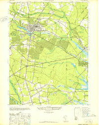
~ Lakewood NJ topo map, 1:24000 scale, 7.5 X 7.5 Minute, Historical, 1947
Lakewood, New Jersey, USGS topographic map dated 1947.
Includes geographic coordinates (latitude and longitude). This topographic map is suitable for hiking, camping, and exploring, or framing it as a wall map.
Printed on-demand using high resolution imagery, on heavy weight and acid free paper, or alternatively on a variety of synthetic materials.
Topos available on paper, Waterproof, Poly, or Tyvek. Usually shipping rolled, unless combined with other folded maps in one order.
- Product Number: USGS-5376120
- Free digital map download (high-resolution, GeoPDF): Lakewood, New Jersey (file size: 10 MB)
- Map Size: please refer to the dimensions of the GeoPDF map above
- Weight (paper map): ca. 55 grams
- Map Type: POD USGS Topographic Map
- Map Series: HTMC
- Map Verison: Historical
- Cell ID: 24760
- Scan ID: 254524
- Woodland Tint: Yes
- Aerial Photo Year: 1942
- Datum: NAD27
- Map Projection: Transverse Mercator
- Map published by United States Army
- Map Language: English
- Scanner Resolution: 600 dpi
- Map Cell Name: Lakewood
- Grid size: 7.5 X 7.5 Minute
- Date on map: 1947
- Map Scale: 1:24000
- Geographical region: New Jersey, United States
Neighboring Maps:
All neighboring USGS topo maps are available for sale online at a variety of scales.
Spatial coverage:
Topo map Lakewood, New Jersey, covers the geographical area associated the following places:
- Bricktown - Silverton - Glen Cedar City - Williams - Leisure Village East - Parkway Pines - Greenville - Lakewood - Pine Acres - Lakewood Corner Estates - Locust Manor - Evergreen Shores - White Oak Bottom - Lanes Mills - Bay Harbor Estates - Pleasant Plains - Coventry Square - South Lakewood - A Country Place - Oak Hill - Laurelton - Seven Stars - Greenbriar - Anchorage - Silverton Pine Terrace - Ramtown - Cedarwood Park - Cedar Bridge - Holiday City - Riviera on the Bay - Cedar Bridge Manor - Chestnut Estates - Edgemere Estates - Laurelton Gardens - Silverton Estates - Larrabees - Lake Riviera - Spruce Gardens - Leisure Village
- Map Area ID: AREA40.12540-74.25-74.125
- Northwest corner Lat/Long code: USGSNW40.125-74.25
- Northeast corner Lat/Long code: USGSNE40.125-74.125
- Southwest corner Lat/Long code: USGSSW40-74.25
- Southeast corner Lat/Long code: USGSSE40-74.125
- Northern map edge Latitude: 40.125
- Southern map edge Latitude: 40
- Western map edge Longitude: -74.25
- Eastern map edge Longitude: -74.125


