
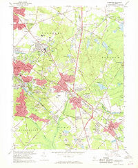
~ Clementon NJ topo map, 1:24000 scale, 7.5 X 7.5 Minute, Historical, 1967, updated 1968
Clementon, New Jersey, USGS topographic map dated 1967.
Includes geographic coordinates (latitude and longitude). This topographic map is suitable for hiking, camping, and exploring, or framing it as a wall map.
Printed on-demand using high resolution imagery, on heavy weight and acid free paper, or alternatively on a variety of synthetic materials.
Topos available on paper, Waterproof, Poly, or Tyvek. Usually shipping rolled, unless combined with other folded maps in one order.
- Product Number: USGS-5375728
- Free digital map download (high-resolution, GeoPDF): Clementon, New Jersey (file size: 12 MB)
- Map Size: please refer to the dimensions of the GeoPDF map above
- Weight (paper map): ca. 55 grams
- Map Type: POD USGS Topographic Map
- Map Series: HTMC
- Map Verison: Historical
- Cell ID: 9100
- Scan ID: 254295
- Imprint Year: 1968
- Woodland Tint: Yes
- Aerial Photo Year: 1965
- Field Check Year: 1967
- Survey Year: 1953
- Datum: NAD27
- Map Projection: Polyconic
- Map published by United States Geological Survey
- Map Language: English
- Scanner Resolution: 600 dpi
- Map Cell Name: Clementon
- Grid size: 7.5 X 7.5 Minute
- Date on map: 1967
- Map Scale: 1:24000
- Geographical region: New Jersey, United States
Neighboring Maps:
All neighboring USGS topo maps are available for sale online at a variety of scales.
Spatial coverage:
Topo map Clementon, New Jersey, covers the geographical area associated the following places:
- Reed Crossing - Lucaston - Berlin Heights - Dicktown - Overbrook - Willow Ridge - Albion - West Berlin - Lindenwold - Ivystone Farms - Kresson - Berlin - Union Mills - Echelon - Haines Corner - Crowfoot - Clementon - Bishops - Glendale - East Berlin - Sharps Corner - Coffins Corner - Alluvium - Tomlinson Mill - Tansboro - Penbryn - Woodcrest Acres - Woodcrest - Marlton Lakes - Pine Valley - New Freedom - Atco - Kirkwood - Gibbsboro - Pine Hill
- Map Area ID: AREA39.87539.75-75-74.875
- Northwest corner Lat/Long code: USGSNW39.875-75
- Northeast corner Lat/Long code: USGSNE39.875-74.875
- Southwest corner Lat/Long code: USGSSW39.75-75
- Southeast corner Lat/Long code: USGSSE39.75-74.875
- Northern map edge Latitude: 39.875
- Southern map edge Latitude: 39.75
- Western map edge Longitude: -75
- Eastern map edge Longitude: -74.875


