
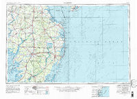
~ Salisbury MD topo map, 1:250000 scale, 1 X 2 Degree, Historical, 1946, updated 1981
Salisbury, Maryland, USGS topographic map dated 1946.
Includes geographic coordinates (latitude and longitude). This topographic map is suitable for hiking, camping, and exploring, or framing it as a wall map.
Printed on-demand using high resolution imagery, on heavy weight and acid free paper, or alternatively on a variety of synthetic materials.
Topos available on paper, Waterproof, Poly, or Tyvek. Usually shipping rolled, unless combined with other folded maps in one order.
- Product Number: USGS-5368760
- Free digital map download (high-resolution, GeoPDF): Salisbury, Maryland (file size: 22 MB)
- Map Size: please refer to the dimensions of the GeoPDF map above
- Weight (paper map): ca. 55 grams
- Map Type: POD USGS Topographic Map
- Map Series: HTMC
- Map Verison: Historical
- Cell ID: 74990
- Scan ID: 257783
- Imprint Year: 1981
- Woodland Tint: Yes
- Edit Year: 1969
- Datum: NAD27
- Map Projection: Transverse Mercator
- Map published by United States Geological Survey
- Map Language: English
- Scanner Resolution: 600 dpi
- Map Cell Name: Salisbury
- Grid size: 1 X 2 Degree
- Date on map: 1946
- Map Scale: 1:250000
- Geographical region: Maryland, United States
Neighboring Maps:
All neighboring USGS topo maps are available for sale online at a variety of scales.
Spatial coverage:
Topo map Salisbury, Maryland, covers the geographical area associated the following places:
- Pinetown - Rehobeth - Whiteleysburg - Herring Landing - Waddells Corner - Shiloh Church - Cloverdale Farm - High Bank Estates - Matyiko Manor - American Corner - Edgewood Park - Walston - Vaughn Landing - Caine Keys - Sussex Shores - Wildwood Crest - Tappers Corner - Bay Vista - Smith Landing - Hebron - Woods Haven - Eden Estates - Sussex Estates - Sea Isle Mobile Home Park - Bishopville - Hickman - Nanticoke Shores Mobile Home Park - Thompsonville - Eastview Park - Fleming Corners - Country Comforts - Blackwater - Dills Acres - Gum Swamp - Sweet Briar Mobile Home Park - Choptank - Stellas Venture - Willards - Swanendael - Ralph - Crestwood - Fernwood - Springfield Farms Addition - Plainfield - Whitesville - Waples - Sinepuxent - Lakeview Estates - Country Club Estates - Passapae Landing - Mount Wesley - Clarksville - The Landing - Ennalls (historical) - Adams Crossroads - Sandy Brae - Beaver Dam Acres - Salisbury - Stage Mobile Home Village - Primehook Beach - Chapel Woods - Star Landing - Hunting Park - Oakley - Rabbit Town - Dunbarton Oaks Apartments - Union Corners - Parker Heights - Rolling Hills - Siloam - Pine Knoll Terrace - Athol - Kitts Hill - Hillsboro - Nentego Manor - Oakdale Acres - Wango - Shell Landing - West Beach - Cannon - Atlanta - Plantation Park II Mobile Home Park - Taylor Landing - Knowles Crossroads - Bennett - Greenwood Manor - Diamond Beach - Cuelen Acres - Teaberry Woods - Douglynn Farms - Goslee Mill - Millville - Lyford Landing - Owl Hollow Acres - Jimtown - Harmon - Patricks Landing - Baileys Landing - Town Bank - Warwick Park
- Map Area ID: AREA3938-76-74
- Northwest corner Lat/Long code: USGSNW39-76
- Northeast corner Lat/Long code: USGSNE39-74
- Southwest corner Lat/Long code: USGSSW38-76
- Southeast corner Lat/Long code: USGSSE38-74
- Northern map edge Latitude: 39
- Southern map edge Latitude: 38
- Western map edge Longitude: -76
- Eastern map edge Longitude: -74


