
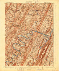
~ Pawpaw WV topo map, 1:62500 scale, 15 X 15 Minute, Historical, 1900, updated 1929
Pawpaw, West Virginia, USGS topographic map dated 1900.
Includes geographic coordinates (latitude and longitude). This topographic map is suitable for hiking, camping, and exploring, or framing it as a wall map.
Printed on-demand using high resolution imagery, on heavy weight and acid free paper, or alternatively on a variety of synthetic materials.
Topos available on paper, Waterproof, Poly, or Tyvek. Usually shipping rolled, unless combined with other folded maps in one order.
- Product Number: USGS-5368438
- Free digital map download (high-resolution, GeoPDF): Pawpaw, West Virginia (file size: 13 MB)
- Map Size: please refer to the dimensions of the GeoPDF map above
- Weight (paper map): ca. 55 grams
- Map Type: POD USGS Topographic Map
- Map Series: HTMC
- Map Verison: Historical
- Cell ID: 60818
- Scan ID: 257596
- Imprint Year: 1929
- Edit Year: 1910
- Survey Year: 1898
- Datum: NAD
- Map Projection: Polyconic
- Map published by United States Geological Survey
- Map Language: English
- Scanner Resolution: 600 dpi
- Map Cell Name: Paw Paw
- Grid size: 15 X 15 Minute
- Date on map: 1900
- Map Scale: 1:62500
- Geographical region: West Virginia, United States
Neighboring Maps:
All neighboring USGS topo maps are available for sale online at a variety of scales.
Spatial coverage:
Topo map Pawpaw, West Virginia, covers the geographical area associated the following places:
- Little Cacapon - Forest Park - Pearre - Barnes Gap - Piney Grove - Hansrote - Artemas - Green Ridge - Lineburg - Great Cacapon - Woodmont - Bellegrove - Cohill - Campbells - Magnolia - Mann - Keifers - Jerome - Doe Gully - Exline - Little Orleans - Green Ridge - Fairplay - Northcraft (historical) - Woodmont - Harvey - Orleans Cross Roads - Paw Paw
- Map Area ID: AREA39.7539.5-78.5-78.25
- Northwest corner Lat/Long code: USGSNW39.75-78.5
- Northeast corner Lat/Long code: USGSNE39.75-78.25
- Southwest corner Lat/Long code: USGSSW39.5-78.5
- Southeast corner Lat/Long code: USGSSE39.5-78.25
- Northern map edge Latitude: 39.75
- Southern map edge Latitude: 39.5
- Western map edge Longitude: -78.5
- Eastern map edge Longitude: -78.25


