
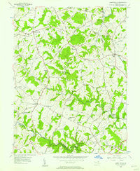
~ Jarrettsville MD topo map, 1:24000 scale, 7.5 X 7.5 Minute, Historical, 1956, updated 1957
Jarrettsville, Maryland, USGS topographic map dated 1956.
Includes geographic coordinates (latitude and longitude). This topographic map is suitable for hiking, camping, and exploring, or framing it as a wall map.
Printed on-demand using high resolution imagery, on heavy weight and acid free paper, or alternatively on a variety of synthetic materials.
Topos available on paper, Waterproof, Poly, or Tyvek. Usually shipping rolled, unless combined with other folded maps in one order.
- Product Number: USGS-5366508
- Free digital map download (high-resolution, GeoPDF): Jarrettsville, Maryland (file size: 12 MB)
- Map Size: please refer to the dimensions of the GeoPDF map above
- Weight (paper map): ca. 55 grams
- Map Type: POD USGS Topographic Map
- Map Series: HTMC
- Map Verison: Historical
- Cell ID: 22407
- Scan ID: 256461
- Imprint Year: 1957
- Woodland Tint: Yes
- Aerial Photo Year: 1954
- Field Check Year: 1956
- Datum: NAD27
- Map Projection: Polyconic
- Map published by United States Geological Survey
- Map Language: English
- Scanner Resolution: 600 dpi
- Map Cell Name: Jarrettsville
- Grid size: 7.5 X 7.5 Minute
- Date on map: 1956
- Map Scale: 1:24000
- Geographical region: Maryland, United States
Neighboring Maps:
All neighboring USGS topo maps are available for sale online at a variety of scales.
Spatial coverage:
Topo map Jarrettsville, Maryland, covers the geographical area associated the following places:
- Tall Oak Manor - Forest Lake - Seven Cedars - Parkwood - Coopstown - Parliament Ridge - Klein - Eagle View - Willows - Charles Manor - Belle Meade - Valewood Estates - Pinehurst - Chadwick - Wales of Harford - Fairview - Sharon Hill - Laurel Brook - Harvest Hills - Sharon Acres - Cedarwood - Laurel Brook - Montford Glen - Ridgecroft - Chrome Hill - Jarrettswood - White House Park - Parkshire - Gunpowder Farms - Steeplechase Manor - Powder Mill Addition - Green Valley - Clover Field - Benson - Rock Spring - Briar Ridge - Round Acres - High Point - Harford Hunt Manor - Lancaster Corner - Haddon Hurst - Oakmont - Advocate Hill Farms - Harford Downs - Vale Hills - Hidden Valley - Springdale - Carroll Meadows - Putnam View Estates - Brandywine Farms - Green Road Manor - Wimbledon - Fallston - Amoss - High Point Manor - Baldwin Mill Terrace - Bel Forest - Clear Spring Estates - Putnam Hill - Forest Hill - Woodridge Manor - Cross Country Estates - The Pond - Rockdale Manor - Putnam Village - Hazelwood - Rock Acres - High Point Estates - Quiet Inheritance - Ferncliff - Hy-Crest - Highfield Park - Timberlea - Franklins Chance - Greenfields - Long Green Manor - Putnam - Woodsbrook - Fallsmont - Vale - Pleasantville - Stirrup Run - Cloverdale - Huntington - Strathmore - Upper Crossroads - Winters Run - Orchard Lakes - Grafton Shops (historical) - Baldwin Hills - Furnace - Wildwood - Village Manor - Dulaney Ridge - Rochelle Meadows - Brook Hill Farms - Bakersfield - Highview Estates - Greendale Estates - Ridgeview
- Map Area ID: AREA39.62539.5-76.5-76.375
- Northwest corner Lat/Long code: USGSNW39.625-76.5
- Northeast corner Lat/Long code: USGSNE39.625-76.375
- Southwest corner Lat/Long code: USGSSW39.5-76.5
- Southeast corner Lat/Long code: USGSSE39.5-76.375
- Northern map edge Latitude: 39.625
- Southern map edge Latitude: 39.5
- Western map edge Longitude: -76.5
- Eastern map edge Longitude: -76.375


