
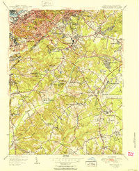
~ Anacostia DC topo map, 1:24000 scale, 7.5 X 7.5 Minute, Historical, 1951
Anacostia, District of Columbia, USGS topographic map dated 1951.
Includes geographic coordinates (latitude and longitude). This topographic map is suitable for hiking, camping, and exploring, or framing it as a wall map.
Printed on-demand using high resolution imagery, on heavy weight and acid free paper, or alternatively on a variety of synthetic materials.
Topos available on paper, Waterproof, Poly, or Tyvek. Usually shipping rolled, unless combined with other folded maps in one order.
- Product Number: USGS-5365624
- Free digital map download (high-resolution, GeoPDF): Anacostia, District of Columbia (file size: 16 MB)
- Map Size: please refer to the dimensions of the GeoPDF map above
- Weight (paper map): ca. 55 grams
- Map Type: POD USGS Topographic Map
- Map Series: HTMC
- Map Verison: Historical
- Cell ID: 916
- Scan ID: 255991
- Woodland Tint: Yes
- Aerial Photo Year: 1949
- Survey Year: 1942
- Datum: NAD27
- Map Projection: Polyconic
- Map published by United States Geological Survey
- Map Language: English
- Scanner Resolution: 600 dpi
- Map Cell Name: Anacostia
- Grid size: 7.5 X 7.5 Minute
- Date on map: 1951
- Map Scale: 1:24000
- Geographical region: District of Columbia, United States
Neighboring Maps:
All neighboring USGS topo maps are available for sale online at a variety of scales.
Spatial coverage:
Topo map Anacostia, District of Columbia, covers the geographical area associated the following places:
- Manchester Estates - Pagetts Corner - Kastle Estates - Randle Highlands - Middleton Farm - Potomac City (historical) - Anacostia - Coral Hills - South Lawn - Douglass Dwellings - Bradbury Park - Jenkins Corner - Oaklawn - Parkland - Temple Hills - Berkshire - Fairfax Village - Broadview - Dupont Park - Knox Hill Dwellings - Dupont Heights - Fort Davis - Woodland - Suitland - Andrews Manor - District Heights - Congress Park - Friendly Hills - Good Hope - Buena Vista - Silver Hill - North Forestville - Murray Hill - Dillon Park - North Barnaby - Auth Village - Apple Grove - Hillcrest Heights - Boulevard Heights - Garfield Heights - Woods Corner - Silver Hill Park - Shipley Terrace - Forest Heights - Bradbury Heights - Forest Manor - Oxon Run Hills - Morningside - Deer Park Heights - Hillside - Hunts Corner - Glassmanor - Waggaman Heights - West Over View - Fort Dupont - Marlow Heights - Palmers Corner - Arnold Heights - Oakland - Colebrooke - Washington Highlands - Camp Springs - Broad Creek - Barnaby Terrace - Clinton - Squires Woods - Phelps Corner - Penn Branch - Oxon Hill - Temple Hills Park - Gordons Corner - Barnaby Manor Oaks - Parkland Terrace - Hyde Field Estates - Hillcrest - Twining - Barry Farms - Naylor Gardens - Pennsylvania Avenue Hights - Fairlawn - Rosecroft Park - Suitland Manor - Friendly - Ballard
- Map Area ID: AREA38.87538.75-77-76.875
- Northwest corner Lat/Long code: USGSNW38.875-77
- Northeast corner Lat/Long code: USGSNE38.875-76.875
- Southwest corner Lat/Long code: USGSSW38.75-77
- Southeast corner Lat/Long code: USGSSE38.75-76.875
- Northern map edge Latitude: 38.875
- Southern map edge Latitude: 38.75
- Western map edge Longitude: -77
- Eastern map edge Longitude: -76.875


