
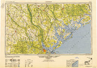
~ Savannah GA topo map, 1:250000 scale, 1 X 2 Degree, Historical, 1948
Savannah, Georgia, USGS topographic map dated 1948.
Includes geographic coordinates (latitude and longitude). This topographic map is suitable for hiking, camping, and exploring, or framing it as a wall map.
Printed on-demand using high resolution imagery, on heavy weight and acid free paper, or alternatively on a variety of synthetic materials.
Topos available on paper, Waterproof, Poly, or Tyvek. Usually shipping rolled, unless combined with other folded maps in one order.
- Product Number: USGS-5365386
- Free digital map download (high-resolution, GeoPDF): Savannah, Georgia (file size: 20 MB)
- Map Size: please refer to the dimensions of the GeoPDF map above
- Weight (paper map): ca. 55 grams
- Map Type: POD USGS Topographic Map
- Map Series: HTMC
- Map Verison: Historical
- Cell ID: 69019
- Scan ID: 247847
- Woodland Tint: Yes
- Aerial Photo Year: 1946
- Edit Year: 1947
- Datum: NAD27
- Map Projection: Transverse Mercator
- Map published by United States Army
- Map Language: English
- Scanner Resolution: 600 dpi
- Map Cell Name: Savannah
- Grid size: 1 X 2 Degree
- Date on map: 1948
- Map Scale: 1:250000
- Geographical region: Georgia, United States
Neighboring Maps:
All neighboring USGS topo maps are available for sale online at a variety of scales.
Spatial coverage:
Topo map Savannah, Georgia, covers the geographical area associated the following places:
- South Sea Pines - Liberty Park - Sea Pines Circle - Pfeiffer (historical) - Northwood Estates - Drawdy - Whitemarsh Island - Possum Corner - Mulberry Grove - Brighton - Ashley Villas - Purysburgh Landing - Radnor (historical) - Fort Bull - Avenue of Oaks - Berrys Landing - Union Junction - Neyles - Heritage Woods - Oakland - Shoreline Farms - Goshen Villa - Savannah Pines Mobile Home Park - Ashley Heights - Hagan - Palmetto Estates - Ashborough East - Estill - Emmalane - Dorchester Manor - Bears Bluff - Enal (historical) - Jericho - Plantation Mobile Home Estates - Greenwood - Iron Crossroads - Russelldale - Eagle Village Mobile Home Park - Groover Landing - Good Hope Landing - Seabrook - Grasslawn Beach - Wadmalaw Island - Walnut Hill - Oakgrove - Green Grove - Lopers Crossroads - Peeples (historical) - Burr Hill - Ashley Hall Manor - Bolon Hall Landing - Stone Park - White Hill - Grays - Azalea Plaza Mobile Home Park - Harbour Town - Wando Gardens - Sylvania - Rouse - Parkers Ferry Landing - Martins Landing - Long Cove Plantation - Sardis - Chandler Lakes - Lawton - Edisto Beach - Copp Landing - Waters - Clyo - Kites Spur (historical) - Forest Hills - Edisto Island - Beaufort - Faber Place - Hunley Park - Round O - Longwood - Shady Grove - Oakdale Estates - Crichton Parish - Telfair Junction - Greenhurst - Otranto - Palmetto Hall Plantation - Claxton - Cooperville - Forest Acres West - Speaks Mill - Ararat - Bennett - Chatham City - Woodstock - Westchester - Edgewood Acres - Seabrook - Burtons Ferry Landing - Hendersonville - Birds - Wiggins - Statesborough
- Map Area ID: AREA3332-82-80
- Northwest corner Lat/Long code: USGSNW33-82
- Northeast corner Lat/Long code: USGSNE33-80
- Southwest corner Lat/Long code: USGSSW32-82
- Southeast corner Lat/Long code: USGSSE32-80
- Northern map edge Latitude: 33
- Southern map edge Latitude: 32
- Western map edge Longitude: -82
- Eastern map edge Longitude: -80


