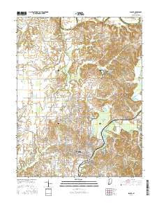
~ Macon GA topo map, 1:250000 scale, 1 X 2 Degree, Historical, 1964
Macon, Georgia, USGS topographic map dated 1964.
Includes geographic coordinates (latitude and longitude). This topographic map is suitable for hiking, camping, and exploring, or framing it as a wall map.
Printed on-demand using high resolution imagery, on heavy weight and acid free paper, or alternatively on a variety of synthetic materials.
Topos available on paper, Waterproof, Poly, or Tyvek. Usually shipping rolled, unless combined with other folded maps in one order.
- Product Number: USGS-5365372
- Free digital map download (high-resolution, GeoPDF): Macon, Georgia (file size: 25 MB)
- Map Size: please refer to the dimensions of the GeoPDF map above
- Weight (paper map): ca. 55 grams
- Map Type: POD USGS Topographic Map
- Map Series: HTMC
- Map Verison: Historical
- Cell ID: 68886
- Scan ID: 247839
- Woodland Tint: Yes
- Visual Version Number: 2
- Aerial Photo Year: 1956
- Field Check Year: 1953
- Datum: Unstated
- Map Projection: Transverse Mercator
- Map published by United States Geological Survey
- Map Language: English
- Scanner Resolution: 600 dpi
- Map Cell Name: Macon
- Grid size: 1 X 2 Degree
- Date on map: 1964
- Map Scale: 1:250000
- Geographical region: Georgia, United States
Neighboring Maps:
All neighboring USGS topo maps are available for sale online at a variety of scales.
Spatial coverage:
Topo map Macon, Georgia, covers the geographical area associated the following places:
- Danton (historical) - Scott - Tremont - Lamb Town - Franklinton - Mount Olive - Springhaven (historical) - Collins - Hazard - Oglethorpe Homes - Five Points - Norristown Junction - Ohoopee - McRae - Byromville - Chappells Mill - Elko - Wesley - Ainslie (historical) - Country Club Estates - Powell - Saint Louis - Hidden Forest - Riverview - Grovania - Brookwood - Tom - Bass - Trails End - Cedar Grove - Mount Calvary - Stevens Crossing - Willow Lake - Sunnydale Acres - Sofkee - Wimbish Wood - Hebron - Harrison - Jones Road Subdivision - Jarrell Heights - Arlington Park - Minter - Toomsboro - Beaver Creek - Spring Hill (historical) - Dooling - Ripley - State College - Weaver Heights - Donovan - Nameless - Lashley - Porter - Cherokee - Kings View - Uvalda - Pinehurst - Wriley - Edgewood - Ohio - Charlotteville - Pabst - Tharpe Heights - Quail Run North - Lake Sardis Estates - Bender (historical) - River West - Almira - Sherwood Forest - Bevinwood - Manning (historical) - Friendship - O'Reily Estates - Cox (historical) - Carr Corners (historical) - Riddleville - Drayton - Finleyson - Windsor Forest - Claybed - Rock Springs - Godwinsville - McIntyre - Cumslo - Tanner - Clayfields - Five Points - College Estates - Brewton - Baileys Park - Blanton Acres - Huber - Lewiston - Blun - Richwood - Grogan - Sigurd (historical) - Cary - Bloomfield Park - Spann
- Map Area ID: AREA3332-84-82
- Northwest corner Lat/Long code: USGSNW33-84
- Northeast corner Lat/Long code: USGSNE33-82
- Southwest corner Lat/Long code: USGSSW32-84
- Southeast corner Lat/Long code: USGSSE32-82
- Northern map edge Latitude: 33
- Southern map edge Latitude: 32
- Western map edge Longitude: -84
- Eastern map edge Longitude: -82

