
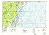
~ Brunswick GA topo map, 1:250000 scale, 1 X 2 Degree, Historical, 1978
Brunswick, Georgia, USGS topographic map dated 1978.
Includes geographic coordinates (latitude and longitude). This topographic map is suitable for hiking, camping, and exploring, or framing it as a wall map.
Printed on-demand using high resolution imagery, on heavy weight and acid free paper, or alternatively on a variety of synthetic materials.
Topos available on paper, Waterproof, Poly, or Tyvek. Usually shipping rolled, unless combined with other folded maps in one order.
- Product Number: USGS-5365358
- Free digital map download (high-resolution, GeoPDF): Brunswick, Georgia (file size: 18 MB)
- Map Size: please refer to the dimensions of the GeoPDF map above
- Weight (paper map): ca. 55 grams
- Map Type: POD USGS Topographic Map
- Map Series: HTMC
- Map Verison: Historical
- Cell ID: 68694
- Scan ID: 247834
- Woodland Tint: Yes
- Visual Version Number: 1
- Aerial Photo Year: 1976
- Edit Year: 1977
- Field Check Year: 1956
- Datum: Unstated
- Map Projection: Transverse Mercator
- Map published by United States Geological Survey
- Map Language: English
- Scanner Resolution: 600 dpi
- Map Cell Name: Brunswick
- Grid size: 1 X 2 Degree
- Date on map: 1978
- Map Scale: 1:250000
- Geographical region: Georgia, United States
Neighboring Maps:
All neighboring USGS topo maps are available for sale online at a variety of scales.
Spatial coverage:
Topo map Brunswick, Georgia, covers the geographical area associated the following places:
- King City - Way Subdivision - Eulonia - Forest River Farms - Wefanie - Waynesville - Glynn Camp - Smiley Crossroads - Dyches Mobile Home Park - Southside Mobile Estates - German Village - Azalea Gardens - Halfmoon Landing - O Neal - Townsend - Meridian - Georgetown - Wilshire - Village Green - Southern Junction - Youngwood - Oglethorpe Park - Waverly - Deerwood - Fraser Acres - Doyles Mobile Home Park - Thalmann - Montgomery - Shady Acres Mobile Home Park - Leicht (historical) - Ashintilly - Ludowici - Gordon Oaks Homes - Country Manor Mobile Home Park - Carnigan - Driftwood Mobile Home Park - Fairhope - McIntyre Court - Nahunta - Marshwood at the Landings - Sandy Run - Lotts (historical) - Berkshire Woods - Magnolia Park - Glynco Annex - Central Park - Sun Hill - Jewtown - Arco - Piney Bluff - Buckhead - Village Bluff - Bradwell Estates - Odessa - Williamsburg Manor - Marshes-of-Mackay - Glynco - Wymberly-On-The-Marsh - Glencoe - High Hill Lake - Brewer (historical) - Glyndale - Oak Level - Demere Park - Martins (historical) - Burnett - The Landings - Thornhill Mobile Home Park - Wilmington Park - Ogeechee Farms - Pendarvis - Highland Park - Aimar - Harrison Heights - Fort Stewart - Groveside Park - Glenwood Estates - Fancy Hall - Bryan Village - Credit Hill - Lampadocia (historical) - Cresthill - Browntown - Herbert Heights - Grimball Park - Doe Run Estates - Sapelo Island - Allenhurst - Riverview - Jenks (historical) - Kent (historical) - Burnside - Bellville Point - Oglethorpe Manor - Beverly Shores - Prosperity - Birdford (historical) - Darien - Dover Bluff - Country Club Estates
- Map Area ID: AREA3231-82-80
- Northwest corner Lat/Long code: USGSNW32-82
- Northeast corner Lat/Long code: USGSNE32-80
- Southwest corner Lat/Long code: USGSSW31-82
- Southeast corner Lat/Long code: USGSSE31-80
- Northern map edge Latitude: 32
- Southern map edge Latitude: 31
- Western map edge Longitude: -82
- Eastern map edge Longitude: -80


