
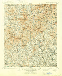
~ Dahlonega GA topo map, 1:125000 scale, 30 X 30 Minute, Historical, 1903, updated 1951
Dahlonega, Georgia, USGS topographic map dated 1903.
Includes geographic coordinates (latitude and longitude). This topographic map is suitable for hiking, camping, and exploring, or framing it as a wall map.
Printed on-demand using high resolution imagery, on heavy weight and acid free paper, or alternatively on a variety of synthetic materials.
Topos available on paper, Waterproof, Poly, or Tyvek. Usually shipping rolled, unless combined with other folded maps in one order.
- Product Number: USGS-5365196
- Free digital map download (high-resolution, GeoPDF): Dahlonega, Georgia (file size: 12 MB)
- Map Size: please refer to the dimensions of the GeoPDF map above
- Weight (paper map): ca. 55 grams
- Map Type: POD USGS Topographic Map
- Map Series: HTMC
- Map Verison: Historical
- Cell ID: 65310
- Scan ID: 247720
- Imprint Year: 1951
- Survey Year: 1900
- Datum: Unstated
- Map Projection: Polyconic
- Map published by United States Geological Survey
- Map Language: English
- Scanner Resolution: 600 dpi
- Map Cell Name: Dahlonega
- Grid size: 30 X 30 Minute
- Date on map: 1903
- Map Scale: 1:125000
- Geographical region: Georgia, United States
Neighboring Maps:
All neighboring USGS topo maps are available for sale online at a variety of scales.
Spatial coverage:
Topo map Dahlonega, Georgia, covers the geographical area associated the following places:
- Dahlonega - Campagne (historical) - Laura (historical) - Clarkesville - Hills - Pleasant Hill - Hunt (historical) - Wikle Store - Porter Springs - Hiawassee - Demorest - Lynch (historical) - Pleasant Retreat (historical) - Fort Smith - Presley - Alexanders Mill - Persimmon - Owltown - Fairview - Hood - Turners Corner - Leo - Friendship - Titus - Bert (historical) - Soquee (historical) - Harvest - Sautee - Willow (historical) - Sunnyside - Garland - Oculus (historical) - Fain - Cleveland - Centerside - Ebenezer - Quebec (historical) - Mountain Scene - Osborn - Kinseytown - Robertstown - Visage (historical) - Naguchee (historical) - Stovall Mill - Midway - Town Creek - Cedar Cliff - Nacoochee - Pinelog - Hood (historical) - Blalock - Habersham - Choestoe - Townsend Mill - Burton (historical) - Habersham Station (historical) - Blairsville - Mossy Creek - College Park - Stay (historical) - Macedonia - Canal Lake - Otto (historical) - Tate City - Welch - Young Harris - Mauldins (historical) - Trackrock (historical) - Youngstown - Yonah - Aerial - Rogers Mill - Tube (historical) - Beech Cove Vista - Warne - Pine Log Village - Gates (historical) - Pink - Spile - Grace (historical) - Pardue Mill - Benefit - Cornelia - Spilo (historical) - Helen - Walnut (historical) - Jacksonville - Mount Airy - Eastburn (historical) - Batesville - Gumlog - Wild (historical) - Leaf - Caldwell (historical) - Tesnatee
- Map Area ID: AREA3534.5-84-83.5
- Northwest corner Lat/Long code: USGSNW35-84
- Northeast corner Lat/Long code: USGSNE35-83.5
- Southwest corner Lat/Long code: USGSSW34.5-84
- Southeast corner Lat/Long code: USGSSE34.5-83.5
- Northern map edge Latitude: 35
- Southern map edge Latitude: 34.5
- Western map edge Longitude: -84
- Eastern map edge Longitude: -83.5


