
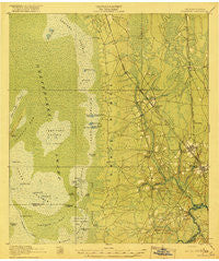
~ Folkston GA topo map, 1:62500 scale, 15 X 15 Minute, Historical, 1918
Folkston, Georgia, USGS topographic map dated 1918.
Includes geographic coordinates (latitude and longitude). This topographic map is suitable for hiking, camping, and exploring, or framing it as a wall map.
Printed on-demand using high resolution imagery, on heavy weight and acid free paper, or alternatively on a variety of synthetic materials.
Topos available on paper, Waterproof, Poly, or Tyvek. Usually shipping rolled, unless combined with other folded maps in one order.
- Product Number: USGS-5364798
- Free digital map download (high-resolution, GeoPDF): Folkston, Georgia (file size: 8 MB)
- Map Size: please refer to the dimensions of the GeoPDF map above
- Weight (paper map): ca. 55 grams
- Map Type: POD USGS Topographic Map
- Map Series: HTMC
- Map Verison: Historical
- Cell ID: 54219
- Scan ID: 247436
- Woodland Tint: Yes
- Survey Year: 1917
- Datum: Unstated
- Map Projection: Unstated
- Map published by United States Army Corps of Engineers
- Map published by United States Department of War
- Map Language: English
- Scanner Resolution: 600 dpi
- Map Cell Name: Folkston
- Grid size: 15 X 15 Minute
- Date on map: 1918
- Map Scale: 1:62500
- Geographical region: Georgia, United States
Neighboring Maps:
All neighboring USGS topo maps are available for sale online at a variety of scales.
Spatial coverage:
Topo map Folkston, Georgia, covers the geographical area associated the following places:
- Mattox - Ferry Landing - Stanley Landing - Silver Hill - Oakdale - Paxton - Cypress Siding - Petersons (historical) - Newell - Uptonville - Folkston - Traders Hill - Homeland
- Map Area ID: AREA3130.75-82.25-82
- Northwest corner Lat/Long code: USGSNW31-82.25
- Northeast corner Lat/Long code: USGSNE31-82
- Southwest corner Lat/Long code: USGSSW30.75-82.25
- Southeast corner Lat/Long code: USGSSE30.75-82
- Northern map edge Latitude: 31
- Southern map edge Latitude: 30.75
- Western map edge Longitude: -82.25
- Eastern map edge Longitude: -82


