
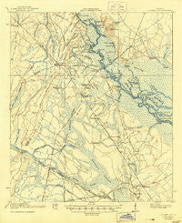
~ Everett City GA topo map, 1:62500 scale, 15 X 15 Minute, Historical, 1920, updated 1944
Everett City, Georgia, USGS topographic map dated 1920.
Includes geographic coordinates (latitude and longitude). This topographic map is suitable for hiking, camping, and exploring, or framing it as a wall map.
Printed on-demand using high resolution imagery, on heavy weight and acid free paper, or alternatively on a variety of synthetic materials.
Topos available on paper, Waterproof, Poly, or Tyvek. Usually shipping rolled, unless combined with other folded maps in one order.
- Product Number: USGS-5364792
- Free digital map download (high-resolution, GeoPDF): Everett City, Georgia (file size: 7 MB)
- Map Size: please refer to the dimensions of the GeoPDF map above
- Weight (paper map): ca. 55 grams
- Map Type: POD USGS Topographic Map
- Map Series: HTMC
- Map Verison: Historical
- Cell ID: 53991
- Scan ID: 247433
- Imprint Year: 1944
- Survey Year: 1917
- Datum: Unstated
- Map Projection: Polyconic
- Map published by United States Army Corps of Engineers
- Map published by United States Department of War
- Map Language: English
- Scanner Resolution: 600 dpi
- Map Cell Name: Everett City
- Grid size: 15 X 15 Minute
- Date on map: 1920
- Map Scale: 1:62500
- Geographical region: Georgia, United States
Neighboring Maps:
All neighboring USGS topo maps are available for sale online at a variety of scales.
Spatial coverage:
Topo map Everett City, Georgia, covers the geographical area associated the following places:
- Southern Pines Mobile Home Village - Leicht (historical) - Thalmann - Lotts (historical) - Jenks (historical) - Anguilla - Lower Sansavilla - Ford (historical) - Belle Vista - Frazers Crossing - Popwellville - Blunt (historical) - Sterling - Mount Pleasant - Akin - Jamaica - Altamaha Park - Live Oak Mobile Home Village - Groveside Park - Brobston - Pine Haven - Everett - Zuta - Pennick - Cox
- Map Area ID: AREA31.531.25-81.75-81.5
- Northwest corner Lat/Long code: USGSNW31.5-81.75
- Northeast corner Lat/Long code: USGSNE31.5-81.5
- Southwest corner Lat/Long code: USGSSW31.25-81.75
- Southeast corner Lat/Long code: USGSSE31.25-81.5
- Northern map edge Latitude: 31.5
- Southern map edge Latitude: 31.25
- Western map edge Longitude: -81.75
- Eastern map edge Longitude: -81.5


