
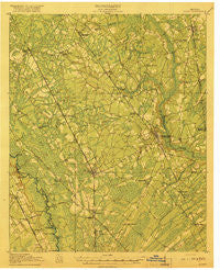
~ Dalton GA topo map, 1:62500 scale, 15 X 15 Minute, Historical, 1919
Dalton, Georgia, USGS topographic map dated 1919.
Includes geographic coordinates (latitude and longitude). This topographic map is suitable for hiking, camping, and exploring, or framing it as a wall map.
Printed on-demand using high resolution imagery, on heavy weight and acid free paper, or alternatively on a variety of synthetic materials.
Topos available on paper, Waterproof, Poly, or Tyvek. Usually shipping rolled, unless combined with other folded maps in one order.
- Product Number: USGS-5364764
- Free digital map download (high-resolution, GeoPDF): Dalton, Georgia (file size: 8 MB)
- Map Size: please refer to the dimensions of the GeoPDF map above
- Weight (paper map): ca. 55 grams
- Map Type: POD USGS Topographic Map
- Map Series: HTMC
- Map Verison: Historical
- Cell ID: 53187
- Scan ID: 247415
- Woodland Tint: Yes
- Survey Year: 1918
- Datum: Unstated
- Map Projection: Unstated
- Map published by United States Army Corps of Engineers
- Map published by United States Department of War
- Map Language: English
- Scanner Resolution: 600 dpi
- Map Cell Name: Dalton
- Grid size: 15 X 15 Minute
- Date on map: 1919
- Map Scale: 1:62500
- Geographical region: Georgia, United States
Neighboring Maps:
All neighboring USGS topo maps are available for sale online at a variety of scales.
Spatial coverage:
Topo map Dalton, Georgia, covers the geographical area associated the following places:
- Temple Grove - Union Point - Varnell - Eton - Prater Mill - Fillmore (historical) - Sumac - Mills (historical) - Edgar (historical) - Red Clay - Norton - Dawnville - Spring Place - Parrett Crossing - Chatsworth - Toonnerville - Ruralvale - Plainview - Pleasant Grove - Cedar Ridge - Beaverdale - Waring - Gregory - Treadwell - Cohutta - Oran - Cedar Valley - Dalton - Cannon Heights - Fort Mountain (historical)
- Map Area ID: AREA3534.75-85-84.75
- Northwest corner Lat/Long code: USGSNW35-85
- Northeast corner Lat/Long code: USGSNE35-84.75
- Southwest corner Lat/Long code: USGSSW34.75-85
- Southeast corner Lat/Long code: USGSSE34.75-84.75
- Northern map edge Latitude: 35
- Southern map edge Latitude: 34.75
- Western map edge Longitude: -85
- Eastern map edge Longitude: -84.75


