
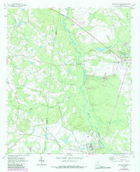
~ Reidsville West GA topo map, 1:24000 scale, 7.5 X 7.5 Minute, Historical, 1970, updated 1987
Reidsville West, Georgia, USGS topographic map dated 1970.
Includes geographic coordinates (latitude and longitude). This topographic map is suitable for hiking, camping, and exploring, or framing it as a wall map.
Printed on-demand using high resolution imagery, on heavy weight and acid free paper, or alternatively on a variety of synthetic materials.
Topos available on paper, Waterproof, Poly, or Tyvek. Usually shipping rolled, unless combined with other folded maps in one order.
- Product Number: USGS-5363622
- Free digital map download (high-resolution, GeoPDF): Reidsville West, Georgia (file size: 10 MB)
- Map Size: please refer to the dimensions of the GeoPDF map above
- Weight (paper map): ca. 55 grams
- Map Type: POD USGS Topographic Map
- Map Series: HTMC
- Map Verison: Historical
- Cell ID: 37569
- Scan ID: 246731
- Imprint Year: 1987
- Woodland Tint: Yes
- Photo Revision Year: 1985
- Aerial Photo Year: 1981
- Edit Year: 1985
- Datum: NAD27
- Map Projection: Polyconic
- Map published by United States Geological Survey
- Map Language: English
- Scanner Resolution: 600 dpi
- Map Cell Name: Reidsville West
- Grid size: 7.5 X 7.5 Minute
- Date on map: 1970
- Map Scale: 1:24000
- Geographical region: Georgia, United States
Neighboring Maps:
All neighboring USGS topo maps are available for sale online at a variety of scales.
Spatial coverage:
Topo map Reidsville West, Georgia, covers the geographical area associated the following places:
- Gordonia Alatamaha Lake - Wardens Cabin Pond Dam - Stanley Ford Bridge - Bowens Pond - Winge Lake - Weyherhauser Dam - Cone Lake Dam - WTNL-AM (Reidsville) - Georgia State Prison - Rocky Creek - Mount Moriah Church - Chicken Yard Pond Dam - Stanleys Store - Chicken Yard Pond - Swinton Smith Field at Reidsville Municipal Airport - Ogden Mill Cemetery - Brazell's Creek Golf Course - Gordonia Alatamaha State Park - Stanley Cemetery - Shepards Bridge - Elza Church - Gordonia Alatamaha Lake Dam - Buck Branch - Cave Cemetery - Rogers State Prison - Wardins Cabin Pond - Watson Creek - Iglesia de Dios Cristo mi Roca - Brazells Creek - WRBX-FM (Reidsville) - Ryals Bridge (historical) - Stanley Cemetery - Georgia State Patrol Troop F Post 18 Reidsville - Ryals Cemetery - Winge Lake Dam - Bowen Lake Dam - Cone Lake
- Map Area ID: AREA32.12532-82.25-82.125
- Northwest corner Lat/Long code: USGSNW32.125-82.25
- Northeast corner Lat/Long code: USGSNE32.125-82.125
- Southwest corner Lat/Long code: USGSSW32-82.25
- Southeast corner Lat/Long code: USGSSE32-82.125
- Northern map edge Latitude: 32.125
- Southern map edge Latitude: 32
- Western map edge Longitude: -82.25
- Eastern map edge Longitude: -82.125


