
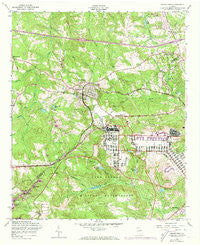
~ Grovetown GA topo map, 1:24000 scale, 7.5 X 7.5 Minute, Historical, 1957, updated 1973
Grovetown, Georgia, USGS topographic map dated 1957.
Includes geographic coordinates (latitude and longitude). This topographic map is suitable for hiking, camping, and exploring, or framing it as a wall map.
Printed on-demand using high resolution imagery, on heavy weight and acid free paper, or alternatively on a variety of synthetic materials.
Topos available on paper, Waterproof, Poly, or Tyvek. Usually shipping rolled, unless combined with other folded maps in one order.
- Product Number: USGS-5362022
- Free digital map download (high-resolution, GeoPDF): Grovetown, Georgia (file size: 14 MB)
- Map Size: please refer to the dimensions of the GeoPDF map above
- Weight (paper map): ca. 55 grams
- Map Type: POD USGS Topographic Map
- Map Series: HTMC
- Map Verison: Historical
- Cell ID: 70267
- Scan ID: 245833
- Imprint Year: 1973
- Woodland Tint: Yes
- Photo Revision Year: 1971
- Aerial Photo Year: 1971
- Datum: NAD27
- Map Projection: Polyconic
- Map published by United States Army Corps of Engineers
- Map Language: English
- Scanner Resolution: 600 dpi
- Map Cell Name: Grovetown
- Grid size: 7.5 X 7.5 Minute
- Date on map: 1957
- Map Scale: 1:24000
- Geographical region: Georgia, United States
Neighboring Maps:
All neighboring USGS topo maps are available for sale online at a variety of scales.
Spatial coverage:
Topo map Grovetown, Georgia, covers the geographical area associated the following places:
- Grovetown - Smithwick - Quail Creek - Tower Pines - Belglade - Sugarcreek - Forrest (historical) - Fort Gordon - Westmont - Silver Maple Ridge - Kettle Creek - Maple Creek - Buffalo Ranch - Lewiston Downs - Ridge Crossing - Ridge Point - Oak Lake - Olive Terrace - Lake Royal - Kensington - Hill and Dale Trailer Park - Avery Landing - Blanchard Park - Windy Acres Trailer Park
- Map Area ID: AREA33.533.375-82.25-82.125
- Northwest corner Lat/Long code: USGSNW33.5-82.25
- Northeast corner Lat/Long code: USGSNE33.5-82.125
- Southwest corner Lat/Long code: USGSSW33.375-82.25
- Southeast corner Lat/Long code: USGSSE33.375-82.125
- Northern map edge Latitude: 33.5
- Southern map edge Latitude: 33.375
- Western map edge Longitude: -82.25
- Eastern map edge Longitude: -82.125


