
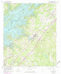
~ Flowery Branch GA topo map, 1:24000 scale, 7.5 X 7.5 Minute, Historical, 1964, updated 1974
Flowery Branch, Georgia, USGS topographic map dated 1964.
Includes geographic coordinates (latitude and longitude). This topographic map is suitable for hiking, camping, and exploring, or framing it as a wall map.
Printed on-demand using high resolution imagery, on heavy weight and acid free paper, or alternatively on a variety of synthetic materials.
Topos available on paper, Waterproof, Poly, or Tyvek. Usually shipping rolled, unless combined with other folded maps in one order.
- Product Number: USGS-5361792
- Free digital map download (high-resolution, GeoPDF): Flowery Branch, Georgia (file size: 15 MB)
- Map Size: please refer to the dimensions of the GeoPDF map above
- Weight (paper map): ca. 55 grams
- Map Type: POD USGS Topographic Map
- Map Series: HTMC
- Map Verison: Historical
- Cell ID: 15647
- Scan ID: 245710
- Imprint Year: 1974
- Woodland Tint: Yes
- Photo Revision Year: 1973
- Aerial Photo Year: 1973
- Datum: NAD27
- Map Projection: Polyconic
- Map published by United States Geological Survey
- Map Language: English
- Scanner Resolution: 600 dpi
- Map Cell Name: Flowery Branch
- Grid size: 7.5 X 7.5 Minute
- Date on map: 1964
- Map Scale: 1:24000
- Geographical region: Georgia, United States
Neighboring Maps:
All neighboring USGS topo maps are available for sale online at a variety of scales.
Spatial coverage:
Topo map Flowery Branch, Georgia, covers the geographical area associated the following places:
- Green Meadows - Woodlake - Hidden Harbor - McClure - Woodbridge - Balus Creek - Johnson - Byers - Flat Creek - Oakwood - Vista Brook - Rest Haven - Waverly Way - Reed - Hammer - Olde Federal Pointe - Forest Park - Beard - Holiday Meadows - Misty Cove - Green Crossing - Southgate - Raintree East - Gay Lan - Sallee Heights - Loch Arbor - Roberts Crossroads - Pleasant View - Flowery Branch - Lake Forest - Scotts Cove - Quail Run - Oscarville - Sagefield - Holland - Trudy Estates - Raintree West - Wayne - Spout Spring Crossroads - Bentwood - Holiday Villa
- Map Area ID: AREA34.2534.125-84-83.875
- Northwest corner Lat/Long code: USGSNW34.25-84
- Northeast corner Lat/Long code: USGSNE34.25-83.875
- Southwest corner Lat/Long code: USGSSW34.125-84
- Southeast corner Lat/Long code: USGSSE34.125-83.875
- Northern map edge Latitude: 34.25
- Southern map edge Latitude: 34.125
- Western map edge Longitude: -84
- Eastern map edge Longitude: -83.875


