
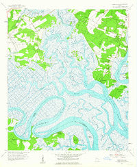
~ Burroughs GA topo map, 1:24000 scale, 7.5 X 7.5 Minute, Historical, 1957, updated 1964
Burroughs, Georgia, USGS topographic map dated 1957.
Includes geographic coordinates (latitude and longitude). This topographic map is suitable for hiking, camping, and exploring, or framing it as a wall map.
Printed on-demand using high resolution imagery, on heavy weight and acid free paper, or alternatively on a variety of synthetic materials.
Topos available on paper, Waterproof, Poly, or Tyvek. Usually shipping rolled, unless combined with other folded maps in one order.
- Product Number: USGS-5360870
- Free digital map download (high-resolution, GeoPDF): Burroughs, Georgia (file size: 11 MB)
- Map Size: please refer to the dimensions of the GeoPDF map above
- Weight (paper map): ca. 55 grams
- Map Type: POD USGS Topographic Map
- Map Series: HTMC
- Map Verison: Historical
- Cell ID: 6393
- Scan ID: 245182
- Imprint Year: 1964
- Woodland Tint: Yes
- Aerial Photo Year: 1951
- Survey Year: 1957
- Datum: NAD27
- Map Projection: Polyconic
- Map published by United States Geological Survey
- Map Language: English
- Scanner Resolution: 600 dpi
- Map Cell Name: Burroughs
- Grid size: 7.5 X 7.5 Minute
- Date on map: 1957
- Map Scale: 1:24000
- Geographical region: Georgia, United States
Neighboring Maps:
All neighboring USGS topo maps are available for sale online at a variety of scales.
Spatial coverage:
Topo map Burroughs, Georgia, covers the geographical area associated the following places:
- Village Green - Colonial Oaks - Burroughs - Grove Point - Berkshire Woods - Southside Mobile Estates - Tranquilla Woods - Dyches Mobile Home Park - Welwood - Mount Pleasant - Windward - White Bluff - Forest River Farms - Leedsgate - Wilshire - Williamsburg Manor - Cedar Grove - Coffee Bluff - Grove Point Mobile Home Estates - Fort McAllister - Windsor Forest - Nicholsonville - Myrtle Grove - Coffee Bluff Plantation - Georgetown - Mount Herman - Windsor on the Marsh
- Map Area ID: AREA3231.875-81.25-81.125
- Northwest corner Lat/Long code: USGSNW32-81.25
- Northeast corner Lat/Long code: USGSNE32-81.125
- Southwest corner Lat/Long code: USGSSW31.875-81.25
- Southeast corner Lat/Long code: USGSSE31.875-81.125
- Northern map edge Latitude: 32
- Southern map edge Latitude: 31.875
- Western map edge Longitude: -81.25
- Eastern map edge Longitude: -81.125


