
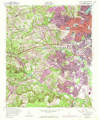
~ Augusta West GA topo map, 1:24000 scale, 7.5 X 7.5 Minute, Historical, 1957, updated 1973
Augusta West, Georgia, USGS topographic map dated 1957.
Includes geographic coordinates (latitude and longitude). This topographic map is suitable for hiking, camping, and exploring, or framing it as a wall map.
Printed on-demand using high resolution imagery, on heavy weight and acid free paper, or alternatively on a variety of synthetic materials.
Topos available on paper, Waterproof, Poly, or Tyvek. Usually shipping rolled, unless combined with other folded maps in one order.
- Product Number: USGS-5360460
- Free digital map download (high-resolution, GeoPDF): Augusta West, Georgia (file size: 17 MB)
- Map Size: please refer to the dimensions of the GeoPDF map above
- Weight (paper map): ca. 55 grams
- Map Type: POD USGS Topographic Map
- Map Series: HTMC
- Map Verison: Historical
- Cell ID: 1859
- Scan ID: 244954
- Imprint Year: 1973
- Woodland Tint: Yes
- Photo Revision Year: 1971
- Aerial Photo Year: 1971
- Datum: NAD27
- Map Projection: Polyconic
- Map published by United States Army Corps of Engineers
- Map Language: English
- Scanner Resolution: 600 dpi
- Map Cell Name: Augusta West
- Grid size: 7.5 X 7.5 Minute
- Date on map: 1957
- Map Scale: 1:24000
- Geographical region: Georgia, United States
Neighboring Maps:
All neighboring USGS topo maps are available for sale online at a variety of scales.
Spatial coverage:
Topo map Augusta West, Georgia, covers the geographical area associated the following places:
- Terrace Manor - Wheless - Golden Terrace - Bridgeport - Southgate Village - Forest Hills - Carmell Mobile Home Park - Mayfair - Pepperidge - Brynwood - Olmstead Homes - Barton Village - Monticello - Green Meadows Estates - Colony Park - Thomas Woods - Silvercrest - Salem - Butler Estates - Meadowlark - Sherwood - Adams (historical) - Quail Hollow - Davison - Hillside Park - Spanish Trace - Windsor Springs Estates - Richmond Gardens - Forest Estates - King Estates - Westwick - Rolling Meadows - Adventure (historical) - McNair Terrace - Norton Acres - Fairvale - Murray Hills - Raes (historical) - Hidden Hills - Carriage Court - Georgetown Estates - Kingston - Glenn Hills - Edenwood - Gaskins Mobile Home Park - Tanglewood - Belair - Forest Acres - Burch Grant - Butler Manor - Bayvale - Southlands - Fleming Heights - Arrow Head - Berckman Villas - Gordon Terrace - Sand Ridge - Ridgewood - Valley Forge - Meadowbrook - Greenbrier - Murphy Mobile Home Park - Berckman Hills - Valley Park - Bellemead - Rockbrook - Woodlake - Duran Mobile Home Park - Oklahoma Hills - Highland Park - Southwick - Westwood - Springfield - Twin Oaks - Richmond Hills - Conifer Place - Highgate - Kendan Park - Fairington - Pine Heights - Neco - Windy Ridge Estates - Oglethorpe Homes - Country Club Hills - Laurel Hill - Plantation Acres Mobile Home Park - Mount Vernon - Shiloh Terrace - Lumpkin Park - Waverly - Summerville - Christa - Northview - Windsor Spring - Bel Air Heights
- Map Area ID: AREA33.533.375-82.125-82
- Northwest corner Lat/Long code: USGSNW33.5-82.125
- Northeast corner Lat/Long code: USGSNE33.5-82
- Southwest corner Lat/Long code: USGSSW33.375-82.125
- Southeast corner Lat/Long code: USGSSE33.375-82
- Northern map edge Latitude: 33.5
- Southern map edge Latitude: 33.375
- Western map edge Longitude: -82.125
- Eastern map edge Longitude: -82


