
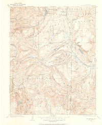
~ San Cristobal CO topo map, 1:125000 scale, 30 X 30 Minute, Historical, 1905, updated 1963
San Cristobal, Colorado, USGS topographic map dated 1905.
Includes geographic coordinates (latitude and longitude). This topographic map is suitable for hiking, camping, and exploring, or framing it as a wall map.
Printed on-demand using high resolution imagery, on heavy weight and acid free paper, or alternatively on a variety of synthetic materials.
Topos available on paper, Waterproof, Poly, or Tyvek. Usually shipping rolled, unless combined with other folded maps in one order.
- Product Number: USGS-5359565
- Free digital map download (high-resolution, GeoPDF): San Cristobal, Colorado (file size: 6 MB)
- Map Size: please refer to the dimensions of the GeoPDF map above
- Weight (paper map): ca. 55 grams
- Map Type: POD USGS Topographic Map
- Map Series: HTMC
- Map Verison: Historical
- Cell ID: 66543
- Scan ID: 402429
- Imprint Year: 1963
- Survey Year: 1905
- Datum: NAD27
- Map Projection: Polyconic
- Map published by United States Geological Survey
- Map Language: English
- Scanner Resolution: 508 dpi
- Map Cell Name: San Cristobai
- Grid size: 30 X 30 Minute
- Date on map: 1905
- Map Scale: 1:125000
- Geographical region: Colorado, United States
Neighboring Maps:
All neighboring USGS topo maps are available for sale online at a variety of scales.
Spatial coverage:
Topo map San Cristobal, Colorado, covers the geographical area associated the following places:
- Gooseberry Creek - Stage Station Flat - Bristol Head Number 2 Dam - Buck Creek - Black Crook Mine - Square Gulch - Meadow Reservoir - Cave Basin Creek - Silver Coin Gulch - West Lost Trail Creek - Wee Ruby Reservoir - Cimarrona Campground - East Fork Weminuche Creek - Road Canyon Number 2 Dam - Rito Hondo Creek - Betty Lake - Little Emerald Lake - Middle Trout Creek - Earl Mullens Dam - Spring Creek Campground - Mill Creek Campground - Castle Lakes Airport - Castle Number 4 Reservoir - Sambrito Creek - Weminuche Creek - Lost Trail Creek - Falls Creek - Sulphur Tunnel - South Clear Creek Camprounds - Woods Canyon - Antelope Park - Palisade Lakes - Fern Creek Stock Driveway - Grassy Mountain - West Ute Lake - Spring Creek Pass - Emerald Lake - Thirtymile Campground - Jarosa Mesa - Palisade Meadows - Love Lake Dam - House Canyon - Wupperman Recreation Site - Whitecross Mountain - Love Lake - Trout Lake - West Ute Creek - Spring Creek Reservoir - Flint Creek - Middle Ute Creek - Milk Creek - Rhodas Arch - Slumgullion Pass Campground - The Window - Fuchs Ditch - Boulder Gulch - East Fork Cebolla Creek - Pointer Lake - Hermit Peak - Big Buck Creek - Cataract Gulch - East Fork Bent Creek - North Clear Creek Falls Overlook - Granite Peak - Texas Point - Cimarrona Peak - Poison Park - Ute Creek - North Fork Los Pinos River - Mesa Lato - Williams Creek - Lean Creek - Slumgullion Earthflow - Quartz Creek - Blue Spruce Canyon - Hossick Creek - Grizzly Gulch - South Clear Creek Falls Campground - Seepage Lake - West Mineral Creek - Jumper Lake - East Ute Creek - East Trout Creek - Weminuche Wilderness - Cuba Gulch - Texas Creek - North Clear Creek - Grouse Creek - Mill Gulch - Little Squaw Creek - Snow Mesa - Woodfern Creek - Windy Point Overlook - Cascade Gulch - Cave Basin - Ghost Lake - Cooper Lake - Ski Hi Ranch - South Clear Creek Falls - Deadman Creek
- Map Area ID: AREA3837.5-107.5-107
- Northwest corner Lat/Long code: USGSNW38-107.5
- Northeast corner Lat/Long code: USGSNE38-107
- Southwest corner Lat/Long code: USGSSW37.5-107.5
- Southeast corner Lat/Long code: USGSSE37.5-107
- Northern map edge Latitude: 38
- Southern map edge Latitude: 37.5
- Western map edge Longitude: -107.5
- Eastern map edge Longitude: -107


