
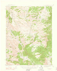
~ Cover Mtn CO topo map, 1:62500 scale, 15 X 15 Minute, Historical, 1948
Cover Mtn , Colorado, USGS topographic map dated 1948.
Includes geographic coordinates (latitude and longitude). This topographic map is suitable for hiking, camping, and exploring, or framing it as a wall map.
Printed on-demand using high resolution imagery, on heavy weight and acid free paper, or alternatively on a variety of synthetic materials.
Topos available on paper, Waterproof, Poly, or Tyvek. Usually shipping rolled, unless combined with other folded maps in one order.
- Product Number: USGS-5358213
- Free digital map download (high-resolution, GeoPDF): Cover Mtn , Colorado (file size: 5 MB)
- Map Size: please refer to the dimensions of the GeoPDF map above
- Weight (paper map): ca. 55 grams
- Map Type: POD USGS Topographic Map
- Map Series: HTMC
- Map Verison: Historical
- Cell ID: 53004
- Scan ID: 402272
- Woodland Tint: Yes
- Survey Year: 1942
- Datum: NAD27
- Map Projection: Polyconic
- Map published by United States Geological Survey
- Map Language: English
- Scanner Resolution: 508 dpi
- Map Cell Name: Cover Mountain
- Grid size: 15 X 15 Minute
- Date on map: 1948
- Map Scale: 1:62500
- Geographical region: Colorado, United States
Neighboring Maps:
All neighboring USGS topo maps are available for sale online at a variety of scales.
Spatial coverage:
Topo map Cover Mtn , Colorado, covers the geographical area associated the following places:
- Rice Mountain - Seep Springs Draw - Albany Mine - Wilson Creek School - Smith Gulch - Thompson Point - Twin Mountain - Webster Park - Currant Creek Mine - Harvey Brothers Reservoir - City Creek - Booger Red Hill - Little Crampton Mountain - Webster Gulch - Whopper Mine - Miner Gulch - Red Cliff Thirty Mine - Horsethief Gulch - Thompson Mountain - Gooseberry Gulch - Sheep Springs - Maverick Gulch - Little Mack Gulch - Mill Gulch - Twelvemile Hole - Washington Gulch - Meadow Gulch - Rowes South Prospect - Cedar Gulch - Cactus Mountain - Little Johnny Dam - Cap Rock Ridge - Lower South Mine - Last Chance Mine - Upper South Mine - South Tallahassee Creek - High Park - Smith Springs - Pine Gulch - Binckley Gulch - Gardner Peak - Beckham Basin - Hoppy Claim - Harvey Brothers Dam - Big Spoon Gulch - Chicken Claim - Star Girl Mine - Big Baldy - Seymour Gulch - Mack Gulch - Climax Mica Mine - Hole in the Rock Gulch - Northwest Fremont Emergency Medical Services - First Chance Mine - Mikesell Gulch - Bear Gulch - Twin Gulch - Stahl Ranch - Shaws Park - Rosemont Mine - Blue Ridge - High Creek - Little Johnny Reservoir - Crampton Mountain - Cover Mountain - Nash Ranch - Gribble Mountain - Red Devil Mine - Isabel Mine - Middle Gooseberry Gulch - Colorado Feldspar Company Mine - Red Rocks Spring - Coyote Creek Ranch Airport - Tallahassee Volunteer Fire Protection Station 5 - Little High Creek - Cap Rock Forty Mine - Bare Hills - Bumback Spring - Venture Number One Mine - Long Gulch - Cottonwood Creek - Newberry Gulch - Twelvemile School - Red Rock Park - Cottonwood Ridge - Rice Gulch - Wann Ranch - Trail Gulch - Twelvemile Park - Rowes Number Two Mine - F L Rowe Ranch - Blue Nugget Mine - Flat Top Ridge - Tickon Prospect - Thompson Gulch - Rowes North Mine - Asher Gulch - Lucky Strike Mine - Sand Gulch
- Map Area ID: AREA38.7538.5-105.5-105.25
- Northwest corner Lat/Long code: USGSNW38.75-105.5
- Northeast corner Lat/Long code: USGSNE38.75-105.25
- Southwest corner Lat/Long code: USGSSW38.5-105.5
- Southeast corner Lat/Long code: USGSSE38.5-105.25
- Northern map edge Latitude: 38.75
- Southern map edge Latitude: 38.5
- Western map edge Longitude: -105.5
- Eastern map edge Longitude: -105.25


