
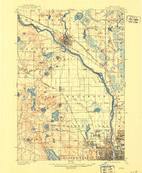
~ Anoka MN topo map, 1:62500 scale, 15 X 15 Minute, Historical, 1902, updated 1921
Anoka, Minnesota, USGS topographic map dated 1902.
Includes geographic coordinates (latitude and longitude). This topographic map is suitable for hiking, camping, and exploring, or framing it as a wall map.
Printed on-demand using high resolution imagery, on heavy weight and acid free paper, or alternatively on a variety of synthetic materials.
Topos available on paper, Waterproof, Poly, or Tyvek. Usually shipping rolled, unless combined with other folded maps in one order.
- Product Number: USGS-5344848
- Free digital map download (high-resolution, GeoPDF): Anoka, Minnesota (file size: 6 MB)
- Map Size: please refer to the dimensions of the GeoPDF map above
- Weight (paper map): ca. 55 grams
- Map Type: POD USGS Topographic Map
- Map Series: HTMC
- Map Verison: Historical
- Cell ID: 50597
- Scan ID: 805448
- Imprint Year: 1921
- Survey Year: 1899
- Datum: Unstated
- Map Projection: Unstated
- Map published by United States Geological Survey
- Map Language: English
- Scanner Resolution: 508 dpi
- Map Cell Name: Anoka
- Grid size: 15 X 15 Minute
- Date on map: 1902
- Map Scale: 1:62500
- Geographical region: Minnesota, United States
Neighboring Maps:
All neighboring USGS topo maps are available for sale online at a variety of scales.
Spatial coverage:
Topo map Anoka, Minnesota, covers the geographical area associated the following places:
- Plymouth - Oak Park - West Coon Rapids - Coon Rapids - New Hope - Anoka - Thompson Riverview Terrace - Brooklyn Park - Osseo - Champlin - Robbinsdale - Fridley - Maple Grove - Golden Valley - Thompson Heights - Northdale - Mission Farms - Columbia Heights - Coon Creek - Andover - Brooklyn Center - Crystal
- Map Area ID: AREA45.2545-93.5-93.25
- Northwest corner Lat/Long code: USGSNW45.25-93.5
- Northeast corner Lat/Long code: USGSNE45.25-93.25
- Southwest corner Lat/Long code: USGSSW45-93.5
- Southeast corner Lat/Long code: USGSSE45-93.25
- Northern map edge Latitude: 45.25
- Southern map edge Latitude: 45
- Western map edge Longitude: -93.5
- Eastern map edge Longitude: -93.25


