
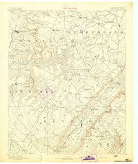
~ Pikeville TN topo map, 1:125000 scale, 30 X 30 Minute, Historical, 1892
Pikeville, Tennessee, USGS topographic map dated 1892.
Includes geographic coordinates (latitude and longitude). This topographic map is suitable for hiking, camping, and exploring, or framing it as a wall map.
Printed on-demand using high resolution imagery, on heavy weight and acid free paper, or alternatively on a variety of synthetic materials.
Topos available on paper, Waterproof, Poly, or Tyvek. Usually shipping rolled, unless combined with other folded maps in one order.
- Product Number: USGS-5339104
- Free digital map download (high-resolution, GeoPDF): Pikeville, Tennessee (file size: 6 MB)
- Map Size: please refer to the dimensions of the GeoPDF map above
- Weight (paper map): ca. 55 grams
- Map Type: POD USGS Topographic Map
- Map Series: HTMC
- Map Verison: Historical
- Cell ID: 66330
- Scan ID: 153481
- Survey Year: 1890
- Datum: Unstated
- Map Projection: Unstated
- Map published by United States Geological Survey
- Map Language: English
- Scanner Resolution: 600 dpi
- Map Cell Name: Pikeville
- Grid size: 30 X 30 Minute
- Date on map: 1892
- Map Scale: 1:125000
- Geographical region: Tennessee, United States
Neighboring Maps:
All neighboring USGS topo maps are available for sale online at a variety of scales.
Spatial coverage:
Topo map Pikeville, Tennessee, covers the geographical area associated the following places:
- Grassland Addition - Erasmus - Winnebago Subdivision - Seminole Subdivision - Morgantown - Perilla (historical) - Baker Crossroads - Ojibwa Subdivision - Smith Chapel - Gladecreek (historical) - Hale Mill - Volunteer Heights - Sweetgum - Woodlawn - Schoolfield (historical) - Meadowview - Music (historical) - Mitchel Heights - Todd Town - Melvine - Maplewood Estates - Phillps Subdivision - The Meadows - Winesap - Thomas Springs - Lake Tansi - Olio (historical) - Harrison Addition - Livesay - Cumberland Heights - Glendale - Luminary - Lanatana Estates - Simpsons - Pleasant View Estates - Burgesstown (historical) - Sparta Hills - Liberty Hill - Shiloh - Middle Brook Place - Oaklyn - Clifty - Sherwood Farm - Dykes Crossroads - Ogden - Griffith - Eastland - Brookhaven - Browntown - Sampson - Hickory Hills - Findlay - Ninemile - North Dayton - Methodist (historical) - Highland Estates - Hart (historical) - Cranmore Cove - Paine Spring - West End - Newton - Hickory Hills - Young (historical) - Foxfire - Legget (historical) - Hillcrest - Lusk - Hitchcox - Sparta - Claysville - Cold Spring - Lonewood - Whispering Hills - Parkview - Heritage Estates - Town Branch Estates - Kiowa Subdivision - Parkway Estates - Litton - West Mill - New Harmony - Stringtown - Oak Hill - South Hills - Hide-A-Way Hills - Pinedale - Rainbow Hills - Hiawatha Subdivision - Bon Air - White Oak Forest - Friendship - Jan Mor Acres - Pomona - Tanbark (historical) - Mount Crest - Cumberland Spring - Cummingsville - Mount Gilead (historical) - Shangrala - River Hill
- Map Area ID: AREA3635.5-85.5-85
- Northwest corner Lat/Long code: USGSNW36-85.5
- Northeast corner Lat/Long code: USGSNE36-85
- Southwest corner Lat/Long code: USGSSW35.5-85.5
- Southeast corner Lat/Long code: USGSSE35.5-85
- Northern map edge Latitude: 36
- Southern map edge Latitude: 35.5
- Western map edge Longitude: -85.5
- Eastern map edge Longitude: -85


