
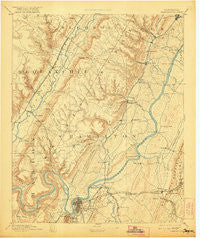
~ Chattanooga TN topo map, 1:125000 scale, 30 X 30 Minute, Historical, 1893, updated 1921
Chattanooga, Tennessee, USGS topographic map dated 1893.
Includes geographic coordinates (latitude and longitude). This topographic map is suitable for hiking, camping, and exploring, or framing it as a wall map.
Printed on-demand using high resolution imagery, on heavy weight and acid free paper, or alternatively on a variety of synthetic materials.
Topos available on paper, Waterproof, Poly, or Tyvek. Usually shipping rolled, unless combined with other folded maps in one order.
- Product Number: USGS-5338944
- Free digital map download (high-resolution, GeoPDF): Chattanooga, Tennessee (file size: 7 MB)
- Map Size: please refer to the dimensions of the GeoPDF map above
- Weight (paper map): ca. 55 grams
- Map Type: POD USGS Topographic Map
- Map Series: HTMC
- Map Verison: Historical
- Cell ID: 65175
- Scan ID: 153502
- Imprint Year: 1921
- Survey Year: 1886
- Datum: Unstated
- Map Projection: Unstated
- Map published by United States Geological Survey
- Map Language: English
- Scanner Resolution: 600 dpi
- Map Cell Name: Chattnooga
- Grid size: 30 X 30 Minute
- Date on map: 1893
- Map Scale: 1:125000
- Geographical region: Tennessee, United States
Neighboring Maps:
All neighboring USGS topo maps are available for sale online at a variety of scales.
Spatial coverage:
Topo map Chattanooga, Tennessee, covers the geographical area associated the following places:
- West View - South Dayton - Olde Mill - Fredonia - Hickory Valley - Drake Forest - Middle Valley - Morrison Springs - Lakeshor Manor - Liberty - Timesville - Hickory Woods - Riggs Trailer Park - Hickory Grove - Boyce - Opossum Creek Pines - Dale Acres - Center Point - Rollingwood - Shore Acres - Montague - Walden - Washington Place - Heritage Hills - Prairie Creek - Bluff View - Clarks Mobile Home Park - Foxwood Estates - Mimosa Trailer Park - Lupton City - Harrison Point - Ware Branch - New Hope - Harbour Woods - Towne Hills - Montclair South - Tiftonia - Ridgewood Acres - Applewood - Metro Park - Summit - Golden Oaks Estates - Country Oaks Estates - Williamsburg Estates - Hampton Woods - Lakeside Park - Soddy-Daisy - Foxwood Heights - Shannon Hills - Moon Shadows - College Hill - Forestdale - Coulterville - Tuckegee (historical) - Daisy - Middle Valley Estates - Summer Haven - East Chattanooga - Shady Grove - Jersey - Dana Hills - Harrison Trailer Park - New Salem - Crestfield - Hampton Heights - Sulphur Springs - Waconda Point - Lake Crest - Tall Oaks Mobile Home Park - Ooltewah - Glendale - Cherokee Woods - Fairhills - Brainerd Hills - Woodland Heights - Daus - Brayton - Hillsboro Heights - Andrea Heights - Glenmar Hills - Tyner - Lockwood Heights - Cartwright - Mountain Shade Mobile Home Park - Stuart Heights - Laurel Creek - Kings Ridge - Soddy - Oak Hill North - Dallas Hills - Holly Heights - Deerwood Forest - Fair Meadows Mobile Home Park - Forest Meade - Green Acres - Signal Mountain - Old Farm - Ela Wada Terrace - Brentwood - Powells Crossroads
- Map Area ID: AREA35.535-85.5-85
- Northwest corner Lat/Long code: USGSNW35.5-85.5
- Northeast corner Lat/Long code: USGSNE35.5-85
- Southwest corner Lat/Long code: USGSSW35-85.5
- Southeast corner Lat/Long code: USGSSE35-85
- Northern map edge Latitude: 35.5
- Southern map edge Latitude: 35
- Western map edge Longitude: -85.5
- Eastern map edge Longitude: -85


