
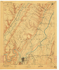
~ Chattanooga TN topo map, 1:125000 scale, 30 X 30 Minute, Historical, 1893, updated 1911
Chattanooga, Tennessee, USGS topographic map dated 1893.
Includes geographic coordinates (latitude and longitude). This topographic map is suitable for hiking, camping, and exploring, or framing it as a wall map.
Printed on-demand using high resolution imagery, on heavy weight and acid free paper, or alternatively on a variety of synthetic materials.
Topos available on paper, Waterproof, Poly, or Tyvek. Usually shipping rolled, unless combined with other folded maps in one order.
- Product Number: USGS-5338942
- Free digital map download (high-resolution, GeoPDF): Chattanooga, Tennessee (file size: 7 MB)
- Map Size: please refer to the dimensions of the GeoPDF map above
- Weight (paper map): ca. 55 grams
- Map Type: POD USGS Topographic Map
- Map Series: HTMC
- Map Verison: Historical
- Cell ID: 65175
- Scan ID: 153501
- Imprint Year: 1911
- Survey Year: 1886
- Datum: Unstated
- Map Projection: Unstated
- Map published by United States Geological Survey
- Map Language: English
- Scanner Resolution: 600 dpi
- Map Cell Name: Chattnooga
- Grid size: 30 X 30 Minute
- Date on map: 1893
- Map Scale: 1:125000
- Geographical region: Tennessee, United States
Neighboring Maps:
All neighboring USGS topo maps are available for sale online at a variety of scales.
Spatial coverage:
Topo map Chattanooga, Tennessee, covers the geographical area associated the following places:
- East Lake - Shady Acres - Five Points - Lakewood - Tiftonia - Northshore Hills - Foxwood Estates - Logan Heights - Pineoak Heights - Harrison Point - Jones Mobile Home Park - Knollwood - Tuckegee (historical) - Armstrong Trailer Park - Woodmore - Ware Branch - Northmont Estates - Fairhills - Shepherd Forest - Lake Hills - Highland Park - Green Gables Mobile Home Park - Midvale - Bella Vista Acres - Valleyview Subdivision - Shady Grove - Fredonia - Fountain Village - Camp Jordan - Lakeside Park - South Dayton - Fanetta Gardens - Colonial Village - Ridge Lake North - Ridgedale - Lake Crest - Ryall Springs - Forest Meade - Red Bank - Claremont - Center Point - Caramel Village - Pineville - Coulterville - North Brainerd - Greens Mill - Smithtown - Bayview - Tyner Hills - Soddy Lake Heights - Hughes (historical) - Marimont - Crabtree Hills - Dallas (historical) - Dallas Heights - Lower Mill - Clarks Mobile Home Park - Valleybrook - Long Branch - Kings Point - Cross Creek - Timberlinks - Webb Trailer Court - Riggs Trailer Park - Towne Hills - Pinebrook Estates - Ridgeside - Sterling Park - Alpine Heights - Cross Timbers - Vista Hills - Rock Ledge Estates - Valley Village - Hickory Woods - Savannah Peninsula - Shore Acres - Harrison Bluff - Mowbray - Flat Top - North Soddy - Mountain Ridge - Claridge - Daus - Garden Farms - Brainerd Hills - Crestfield - Farrington Forest - Palisades - Gold Point Estates - Bluff View - Hillsboro Heights - Snow Hill - Auburn Hills - Ooltewah - Prairie Creek - Huntingdon Forest - Brainerd Park - Cloverdale Estates - Port Serena - Edwards Point
- Map Area ID: AREA35.535-85.5-85
- Northwest corner Lat/Long code: USGSNW35.5-85.5
- Northeast corner Lat/Long code: USGSNE35.5-85
- Southwest corner Lat/Long code: USGSSW35-85.5
- Southeast corner Lat/Long code: USGSSE35-85
- Northern map edge Latitude: 35.5
- Southern map edge Latitude: 35
- Western map edge Longitude: -85.5
- Eastern map edge Longitude: -85


