
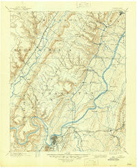
~ Chattanooga TN topo map, 1:125000 scale, 30 X 30 Minute, Historical, 1893, updated 1945
Chattanooga, Tennessee, USGS topographic map dated 1893.
Includes geographic coordinates (latitude and longitude). This topographic map is suitable for hiking, camping, and exploring, or framing it as a wall map.
Printed on-demand using high resolution imagery, on heavy weight and acid free paper, or alternatively on a variety of synthetic materials.
Topos available on paper, Waterproof, Poly, or Tyvek. Usually shipping rolled, unless combined with other folded maps in one order.
- Product Number: USGS-5338926
- Free digital map download (high-resolution, GeoPDF): Chattanooga, Tennessee (file size: 7 MB)
- Map Size: please refer to the dimensions of the GeoPDF map above
- Weight (paper map): ca. 55 grams
- Map Type: POD USGS Topographic Map
- Map Series: HTMC
- Map Verison: Historical
- Cell ID: 65175
- Scan ID: 148917
- Imprint Year: 1945
- Survey Year: 1886
- Datum: Unstated
- Map Projection: Polyconic
- Map published by United States Geological Survey
- Map Language: English
- Scanner Resolution: 600 dpi
- Map Cell Name: Chattnooga
- Grid size: 30 X 30 Minute
- Date on map: 1893
- Map Scale: 1:125000
- Geographical region: Tennessee, United States
Neighboring Maps:
All neighboring USGS topo maps are available for sale online at a variety of scales.
Spatial coverage:
Topo map Chattanooga, Tennessee, covers the geographical area associated the following places:
- Ponderosa Pines - Falling Water - Opossum Creek Pines - Timberlinks - Royal Oaks - Claridge - Hidden Harbor - Summer Haven - Dowler Heights - Forest Hills - Edgemont Forest - Shepherd - Center Point - Webb Trailer Court - Holly Heights - Elm Hill - Flat Top - Sterling Park - West View - Crestfield - Cross Creek - Jones Mobile Home Park - Northwoods - Avondale - Alton Park - Harrison - Fair Meadows Mobile Home Park - Northmont Estates - Bella Vista Acres - Boyce - Tuckegee (historical) - Ela Wada Terrace - Logan Heights - Kings Point - Dallas Crest - Concord Heights - Cross Timbers - Lake Vista - Mountain Ridge - South Brainerd - Pailo - Mountain View - East Ridge - Stoneridge - Deerwood Forest - Hickory Woods - New Hope - Northshore Estates - North Tower Forest - Old Farm - Arcadia Shores - Riverview - Ridgedale - Soddy - Red Bank - River Oaks - Dale Acres - Clearwater Acres - Bushtown - Montague - Indian Hills - Signal Hills - Dallas Hills - Blue Ridge View - Fairview - Foxwood Heights - Cagle - Forest Park - Chattanooga - Spring Valley - Crabtree Hills - Fountain Village - White Oak - Regency Place - Harbour Woods - North Soddy - Springvale - Glendale - Condra - Norcross Hills - Long Branch - Glenwood - Dana Hills - Armstrong Trailer Park - Shelton Estates - Savannah Peninsula - Daisy - Huntingdon Forest - Richland Crest - Huckleberry - Oak Hill North - Poindexter Heights - East Lake - Laurel Brook - Gold Point Estates - Highland Park - Mineral Park - Savannah Bay - Lakesite - Morrison Springs
- Map Area ID: AREA35.535-85.5-85
- Northwest corner Lat/Long code: USGSNW35.5-85.5
- Northeast corner Lat/Long code: USGSNE35.5-85
- Southwest corner Lat/Long code: USGSSW35-85.5
- Southeast corner Lat/Long code: USGSSE35-85
- Northern map edge Latitude: 35.5
- Southern map edge Latitude: 35
- Western map edge Longitude: -85.5
- Eastern map edge Longitude: -85


