
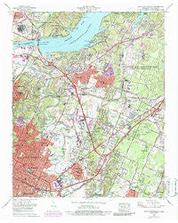
~ East Chattanooga TN topo map, 1:24000 scale, 7.5 X 7.5 Minute, Historical, 1969, updated 1987
East Chattanooga, Tennessee, USGS topographic map dated 1969.
Includes geographic coordinates (latitude and longitude). This topographic map is suitable for hiking, camping, and exploring, or framing it as a wall map.
Printed on-demand using high resolution imagery, on heavy weight and acid free paper, or alternatively on a variety of synthetic materials.
Topos available on paper, Waterproof, Poly, or Tyvek. Usually shipping rolled, unless combined with other folded maps in one order.
- Product Number: USGS-5334052
- Free digital map download (high-resolution, GeoPDF): East Chattanooga, Tennessee (file size: 16 MB)
- Map Size: please refer to the dimensions of the GeoPDF map above
- Weight (paper map): ca. 55 grams
- Map Type: POD USGS Topographic Map
- Map Series: HTMC
- Map Verison: Historical
- Cell ID: 13352
- Scan ID: 143891
- Imprint Year: 1987
- Woodland Tint: Yes
- Visual Version Number: 2
- Photo Revision Year: 1976
- Aerial Photo Year: 1976
- Edit Year: 1969
- Field Check Year: 1969
- Datum: NAD27
- Map Projection: Polyconic
- Map published by Tennessee Valley Authority
- Map Language: English
- Scanner Resolution: 600 dpi
- Map Cell Name: East Chattanooga
- Grid size: 7.5 X 7.5 Minute
- Date on map: 1969
- Map Scale: 1:24000
- Geographical region: Tennessee, United States
Neighboring Maps:
All neighboring USGS topo maps are available for sale online at a variety of scales.
Spatial coverage:
Topo map East Chattanooga, Tennessee, covers the geographical area associated the following places:
- Dale Acres - Riggs Trailer Park - Foxwood Heights - Talley Place - Tyner - Kings Point - Pineoak Heights - Glenmar Hills - Brainerd - Lakeshor Manor - Northshore Estates - Hamillville - Engleton Heights - Harrison - Marimont - Edgemont Forest - Deerwood Forest - Harbour Woods - Washington Heights - Creekwood Terrace - Hickory Hills - Holiday Hills - Gaylan Heights - Regency Place - Ela Wada Terrace - Washington Hills - Brentwood - Capital Heights - Cambridge Estates - Rollingwood - Shallowford Hills - Shady Rest - Cherokee Woods - Bayview - Royal Oaks - Harbor Heights - Brookfield - Turkeyfoot - Bella Vista Acres - South Brainerd - Theresa Heights - Shawnee Park - Lake Vista - Hillsboro Heights - Silverdale - Vista Hills - East Chattanooga - Acres of Shade Mobile Home Park - Camp Jordan - Radmoor - North Tower Forest - Concord Heights - Forest Hills - Jersey - Brainerd Hills - North Brainerd - Drake Forest - Tyner Hills - Brainerd Park - Indian Hills - Harrison Point - Holy Hills - Eastdale - Heritage Hills - Bartlebaugh - Shepherd - River Oaks - Battery Heights - Woodmore - Hickory Valley - Murray Hills - Austin Farm - Lake Hills - Washington Place - Ridgewood Acres - Whispering Pines Mobile Home Park - Lakeshore Estates - Logan Heights
- Map Area ID: AREA35.12535-85.25-85.125
- Northwest corner Lat/Long code: USGSNW35.125-85.25
- Northeast corner Lat/Long code: USGSNE35.125-85.125
- Southwest corner Lat/Long code: USGSSW35-85.25
- Southeast corner Lat/Long code: USGSSE35-85.125
- Northern map edge Latitude: 35.125
- Southern map edge Latitude: 35
- Western map edge Longitude: -85.25
- Eastern map edge Longitude: -85.125


