
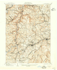
~ Houtzdale PA topo map, 1:62500 scale, 15 X 15 Minute, Historical, 1905, updated 1937
Houtzdale, Pennsylvania, USGS topographic map dated 1905.
Includes geographic coordinates (latitude and longitude). This topographic map is suitable for hiking, camping, and exploring, or framing it as a wall map.
Printed on-demand using high resolution imagery, on heavy weight and acid free paper, or alternatively on a variety of synthetic materials.
Topos available on paper, Waterproof, Poly, or Tyvek. Usually shipping rolled, unless combined with other folded maps in one order.
- Product Number: USGS-5330390
- Free digital map download (high-resolution, GeoPDF): Houtzdale, Pennsylvania (file size: 9 MB)
- Map Size: please refer to the dimensions of the GeoPDF map above
- Weight (paper map): ca. 55 grams
- Map Type: POD USGS Topographic Map
- Map Series: HTMC
- Map Verison: Historical
- Cell ID: 55513
- Scan ID: 167880
- Imprint Year: 1937
- Visual Version Number: 1
- Survey Year: 1903
- Datum: NAD
- Map Projection: Polyconic
- Map published by United States Geological Survey
- Map Language: English
- Scanner Resolution: 600 dpi
- Map Cell Name: Houtzdale
- Grid size: 15 X 15 Minute
- Date on map: 1905
- Map Scale: 1:62500
- Geographical region: Pennsylvania, United States
Neighboring Maps:
All neighboring USGS topo maps are available for sale online at a variety of scales.
Spatial coverage:
Topo map Houtzdale, Pennsylvania, covers the geographical area associated the following places:
- West Moshannon - Woodland - Gearhartville - Beccaria - Sanborn - New Town - Goss Run Junction - Amesville - Smoke Run - Bigler - Mascot (historical) - Spring Valley - New London - Fernwood - Oshanter - West Decatur - Decaturville - Burly - New Liberty - Madera - Kendrick - Hegarty Crossroads - Edendale - Oak Ridge - Glen Richey - Almaden - Spike Island - Beulah - Osceola Mills - Banian Junction - Booker - Whiteside - Boardman - Stumptown - Mineral Springs - Morann - Jeffries - Henderson - Belsena - Atlantic - Wallaceton - Ashland - Drane - Victor - Penn Five - Betz - Faunce - Earnestville - Krebs - Beaverton - Viola - Houtzdale - New Castle - Ginter - Kellytown - Parsonsville - Pine Top - Janesville - Sterling - Brisbin - Scotch Hollow - Ramey - Chesterfield - Blue Ball - Mount Hope - Waltzvale - Hale - Newtown - Pine Grove
- Map Area ID: AREA4140.75-78.5-78.25
- Northwest corner Lat/Long code: USGSNW41-78.5
- Northeast corner Lat/Long code: USGSNE41-78.25
- Southwest corner Lat/Long code: USGSSW40.75-78.5
- Southeast corner Lat/Long code: USGSSE40.75-78.25
- Northern map edge Latitude: 41
- Southern map edge Latitude: 40.75
- Western map edge Longitude: -78.5
- Eastern map edge Longitude: -78.25


