
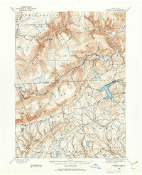
~ Harveys Lake PA topo map, 1:62500 scale, 15 X 15 Minute, Historical, 1891, updated 1962
Harveys Lake, Pennsylvania, USGS topographic map dated 1891.
Includes geographic coordinates (latitude and longitude). This topographic map is suitable for hiking, camping, and exploring, or framing it as a wall map.
Printed on-demand using high resolution imagery, on heavy weight and acid free paper, or alternatively on a variety of synthetic materials.
Topos available on paper, Waterproof, Poly, or Tyvek. Usually shipping rolled, unless combined with other folded maps in one order.
- Product Number: USGS-5330300
- Free digital map download (high-resolution, GeoPDF): Harveys Lake, Pennsylvania (file size: 9 MB)
- Map Size: please refer to the dimensions of the GeoPDF map above
- Weight (paper map): ca. 55 grams
- Map Type: POD USGS Topographic Map
- Map Series: HTMC
- Map Verison: Historical
- Cell ID: 55138
- Scan ID: 171915
- Imprint Year: 1962
- Survey Year: 1891
- Datum: NAD27
- Map Projection: Polyconic
- Map published by United States Geological Survey
- Map Language: English
- Scanner Resolution: 600 dpi
- Map Cell Name: Harveys Lake
- Grid size: 15 X 15 Minute
- Date on map: 1891
- Map Scale: 1:62500
- Geographical region: Pennsylvania, United States
Neighboring Maps:
All neighboring USGS topo maps are available for sale online at a variety of scales.
Spatial coverage:
Topo map Harveys Lake, Pennsylvania, covers the geographical area associated the following places:
- Kasson Brook - Sweet Valley - Rittenhouse - Harveys Lake - Bellasylva - Ruggles - Loyalville - Fades - Ruggles - Stull - Kyttle - Laketon - Pikes Creek - Idetown - Lake - Roaring Brook - Ripple (historical) - Weintz - Noxen - Lehman - Prichard - Ripple - Shawanese - Cease Mills - Wordan Place - Meeker - Silkworth - Bowman Creek - Hettesheimer Corners - Ceasetown - Evans Falls - Outlet
- Map Area ID: AREA41.541.25-76.25-76
- Northwest corner Lat/Long code: USGSNW41.5-76.25
- Northeast corner Lat/Long code: USGSNE41.5-76
- Southwest corner Lat/Long code: USGSSW41.25-76.25
- Southeast corner Lat/Long code: USGSSE41.25-76
- Northern map edge Latitude: 41.5
- Southern map edge Latitude: 41.25
- Western map edge Longitude: -76.25
- Eastern map edge Longitude: -76


