
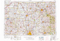
~ Marion OH topo map, 1:250000 scale, 1 X 2 Degree, Historical, 1966, updated 1976
Marion, Ohio, USGS topographic map dated 1966.
Includes geographic coordinates (latitude and longitude). This topographic map is suitable for hiking, camping, and exploring, or framing it as a wall map.
Printed on-demand using high resolution imagery, on heavy weight and acid free paper, or alternatively on a variety of synthetic materials.
Topos available on paper, Waterproof, Poly, or Tyvek. Usually shipping rolled, unless combined with other folded maps in one order.
- Product Number: USGS-5321596
- Free digital map download (high-resolution, GeoPDF): Marion, Ohio (file size: 17 MB)
- Map Size: please refer to the dimensions of the GeoPDF map above
- Weight (paper map): ca. 55 grams
- Map Type: POD USGS Topographic Map
- Map Series: HTMC
- Map Verison: Historical
- Cell ID: 75002
- Scan ID: 225745
- Imprint Year: 1976
- Woodland Tint: Yes
- Aerial Photo Year: 1960
- Field Check Year: 1966
- Datum: Unstated
- Map Projection: Transverse Mercator
- Map published by United States Geological Survey
- Map Language: English
- Scanner Resolution: 600 dpi
- Map Cell Name: Marion
- Grid size: 1 X 2 Degree
- Date on map: 1966
- Map Scale: 1:250000
- Geographical region: Ohio, United States
Neighboring Maps:
All neighboring USGS topo maps are available for sale online at a variety of scales.
Spatial coverage:
Topo map Marion, Ohio, covers the geographical area associated the following places:
- Nottingham - Little Sandusky - Rowsburg - Avery Estates - Oakland - New Bloomington - Morrison Farms - Waterford Glen - Green Camp - Pipesville - Beaver Dam Station - Shady Lane Mobile Home Park - Cheshire Crossing - Newville - Fauser (historical) - Bluffton - Colonial Hills - New Way - Toboso - Creekstone - Pinhook - Tunnel Hill - Esto - Albany Park - Whispering Creek - Asbury Heights - Dale Avenue Mobile Home Park - Windy Corner - Five Points - Tiverton Center - Carriage Run - Heath - Pleasant View Mobile Home Park - Belle Avenue Trailer Court - Mount Cory - Grant - Shelby Mobile Home Park - Middletown - Coventry Manor - Waterston - West Union (historical) - Worthington Arms - Ridgeton - The Woods At Havens Run - Baddow Pass (historical) - Mifflinville - Mifflin Cottage Area - West Newton - Irwin - Knox - Granville - South Condit - Tylers Corners - Holmesville (historical) - Richland (historical) - Sycamore - Tobias - Vails Corners - Morgan Center - New Pittsburg - Oakland Mobile Home Park - Danville - Lewis Center - Walnut Grove Estates - Umbria (historical) - Moores Corners - Havens Corners - Country View Mobile Home Park - Colts Neck - Kingston Center - Dublin - Muchinippi (historical) - Alexandria - Miley Crossroads - Worthington - Mount Vernon - Lippincott - Old Pimtown (historical) - Kirby - Olentangy Falls - West Liberty - Troyton - Bangs - Patterson - Rain Rock - Highwater - Marion - Plain City - Warsaw Junction - Buckeye Trailer Park - Meeker - Planters Grove - Lunda - Mackachack (historical) - Mackstown - Hillcrest Mobile Home Park - Bowsherville (historical) - Amlin - Redhaw - Mobile Manor Park
- Map Area ID: AREA4140-84-82
- Northwest corner Lat/Long code: USGSNW41-84
- Northeast corner Lat/Long code: USGSNE41-82
- Southwest corner Lat/Long code: USGSSW40-84
- Southeast corner Lat/Long code: USGSSE40-82
- Northern map edge Latitude: 41
- Southern map edge Latitude: 40
- Western map edge Longitude: -84
- Eastern map edge Longitude: -82


