
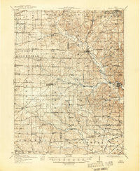
~ Shauck OH topo map, 1:62500 scale, 15 X 15 Minute, Historical, 1915, updated 1946
Shauck, Ohio, USGS topographic map dated 1915.
Includes geographic coordinates (latitude and longitude). This topographic map is suitable for hiking, camping, and exploring, or framing it as a wall map.
Printed on-demand using high resolution imagery, on heavy weight and acid free paper, or alternatively on a variety of synthetic materials.
Topos available on paper, Waterproof, Poly, or Tyvek. Usually shipping rolled, unless combined with other folded maps in one order.
- Product Number: USGS-5321290
- Free digital map download (high-resolution, GeoPDF): Shauck, Ohio (file size: 8 MB)
- Map Size: please refer to the dimensions of the GeoPDF map above
- Weight (paper map): ca. 55 grams
- Map Type: POD USGS Topographic Map
- Map Series: HTMC
- Map Verison: Historical
- Cell ID: 62409
- Scan ID: 227081
- Imprint Year: 1946
- Survey Year: 1913
- Datum: NAD
- Map Projection: Polyconic
- Map published by United States Geological Survey
- Map Language: English
- Scanner Resolution: 600 dpi
- Map Cell Name: Shauck
- Grid size: 15 X 15 Minute
- Date on map: 1915
- Map Scale: 1:62500
- Geographical region: Ohio, United States
Neighboring Maps:
All neighboring USGS topo maps are available for sale online at a variety of scales.
Spatial coverage:
Topo map Shauck, Ohio, covers the geographical area associated the following places:
- Darlington - Williamsport - Ankenytown - Bangorville - Steam Corners - Ken-mar Mobile Home Park - Hanley Village - North Woodbury - Jackson - Blooming Grove - Kings Corners - South Boulevards - Waterford - Kellker (historical) - Palmyra - Shauck - Lexington - Batemantown - Jugs Corners - Alta - Pulaskiville - Country Estates Mobile Home Park - Bellville - Millsboro
- Map Area ID: AREA40.7540.5-82.75-82.5
- Northwest corner Lat/Long code: USGSNW40.75-82.75
- Northeast corner Lat/Long code: USGSNE40.75-82.5
- Southwest corner Lat/Long code: USGSSW40.5-82.75
- Southeast corner Lat/Long code: USGSSE40.5-82.5
- Northern map edge Latitude: 40.75
- Southern map edge Latitude: 40.5
- Western map edge Longitude: -82.75
- Eastern map edge Longitude: -82.5


