
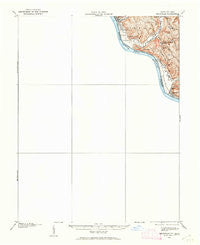
~ Maysville KY topo map, 1:62500 scale, 15 X 15 Minute, Historical, 1915, updated 1962
Maysville, Kentucky, USGS topographic map dated 1915.
Includes geographic coordinates (latitude and longitude). This topographic map is suitable for hiking, camping, and exploring, or framing it as a wall map.
Printed on-demand using high resolution imagery, on heavy weight and acid free paper, or alternatively on a variety of synthetic materials.
Topos available on paper, Waterproof, Poly, or Tyvek. Usually shipping rolled, unless combined with other folded maps in one order.
- Product Number: USGS-5321084
- Free digital map download (high-resolution, GeoPDF): Maysville, Kentucky (file size: 3 MB)
- Map Size: please refer to the dimensions of the GeoPDF map above
- Weight (paper map): ca. 55 grams
- Map Type: POD USGS Topographic Map
- Map Series: HTMC
- Map Verison: Historical
- Cell ID: 57297
- Scan ID: 227783
- Imprint Year: 1962
- Survey Year: 1915
- Datum: NAD27
- Map Projection: Polyconic
- Map published by United States Geological Survey
- Map Language: English
- Scanner Resolution: 600 dpi
- Map Cell Name: Maysville
- Grid size: 15 X 15 Minute
- Date on map: 1915
- Map Scale: 1:62500
- Geographical region: Kentucky, United States
Neighboring Maps:
All neighboring USGS topo maps are available for sale online at a variety of scales.
Spatial coverage:
Topo map Maysville, Kentucky, covers the geographical area associated the following places:
- Huntington Park - Aberdeen - Germantown - South Ripley - Manley (historical) - Marshall - Warren Smith Trailer Park - Ogden Ridge (historical) - Murphysville - Hestoria - Dexter (historical) - Shannon - Minerva - Simon Kenton Acres (historical) - Clems Shady Nook Park - Five Lick Creek (historical) - Abigail - Mays Lick - Moranburg - East Ripley - Shawnee Hill (historical) - Fernleaf - Country Club Heights - Old Washington - Sardis - Lewisburg - Ripley
- Map Area ID: AREA38.7538.5-84-83.75
- Northwest corner Lat/Long code: USGSNW38.75-84
- Northeast corner Lat/Long code: USGSNE38.75-83.75
- Southwest corner Lat/Long code: USGSSW38.5-84
- Southeast corner Lat/Long code: USGSSE38.5-83.75
- Northern map edge Latitude: 38.75
- Southern map edge Latitude: 38.5
- Western map edge Longitude: -84
- Eastern map edge Longitude: -83.75


